Comprehensive Wastewater Plan (CWMP)
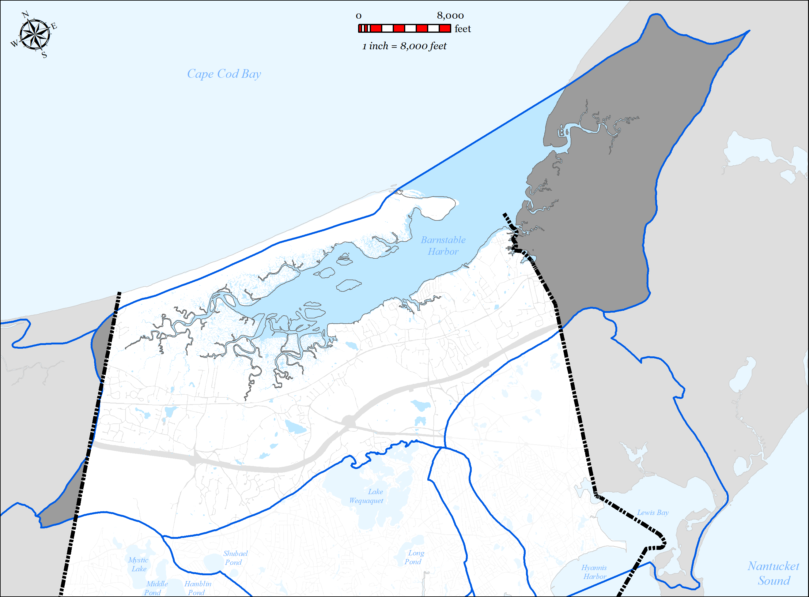
The Barnstable Harbor Embayment System (also referred to as the Barnstable Great Marsh System) is located on the north side of the Town of Barnstable and extends into the towns of Sandwich, Yarmouth and Dennis. The system has a northern shore bounded by a narrow barrier beach, known as Sandy Neck, which separates the Harbor from Cape Cod Bay, with which it exchanges tidal waters. Due to the large tidal flow experienced in Barnstable Harbor, the embayment has been determined to have assimilative capacity with respect to nitrogen, except for the Millway sub-embayment (located in Barnstable Village). For a detailed description of the embayment system, refer to the 2017 Draft MEP Report (Appendix CC).
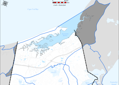
The Barnstable Harbor Watershed is the source water for the Barnstable Harbor Embayment System. The Barnstable Harbor Watershed is predominantly located within the Town of Barnstable but also extends into the towns of Yarmouth, Dennis and Sandwich (see Figure 5-67). Within the total watershed there are 63 identified surface waters including 18 named freshwater ponds and 3 significant freshwater stream outlets. The 2 significant freshwater stream outlets in the Barnstable Harbor Watershed that are located in the Town of Barnstable are: Bridge Creek and Brickyard Creek. There are 3 public drinking water wells operated by Barnstable Water District located within the watershed within the limits of the Town of Barnstable. Additionally, the Village of West Barnstable is located within the watershed and is predominantly serviced by private on-site drinking water wells. There are no municipally operated wastewater treatment facilities within the watershed.
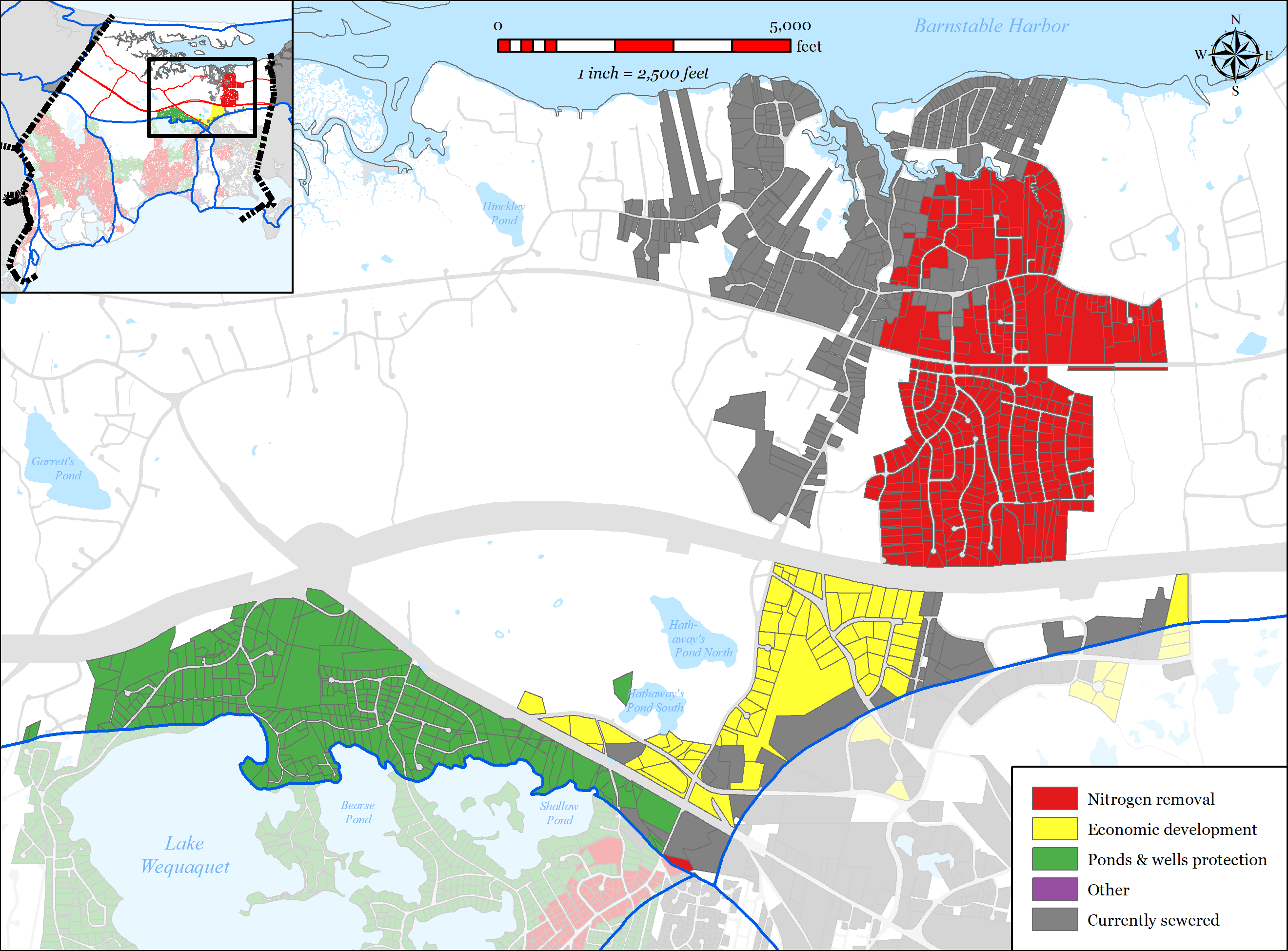
The Town of Barnstable’s wastewater plan has been designed to address multiple needs areas within the Barnstable Harbor Watershed, including nutrient removal, pond protection, water supply protection, flood zone considerations, and economic development, via sewer expansion within the watershed.
5.2.7.1 SUMMARY OF NEEDS
The Town of Barnstable’s wastewater plan has been designed to address multiple needs areas within the Barnstable Harbor Watershed, including nutrient removal, pond protection, water supply protection, flood zone considerations and economic development, via sewer expansion within the Barnstable Harbor Watershed.
-
-
-
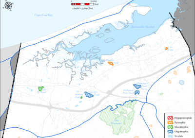
Figure 5-67: Barnstable Harbor Watershed
-

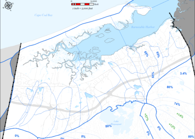
Figure 5-68: MEP-modeled Existing Septic Removal in Barnstable Harbor Watershed
-
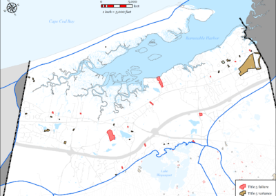
Figure 5-69: Impaired Ponds in Barnstable Harbor Watershed
-
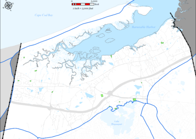
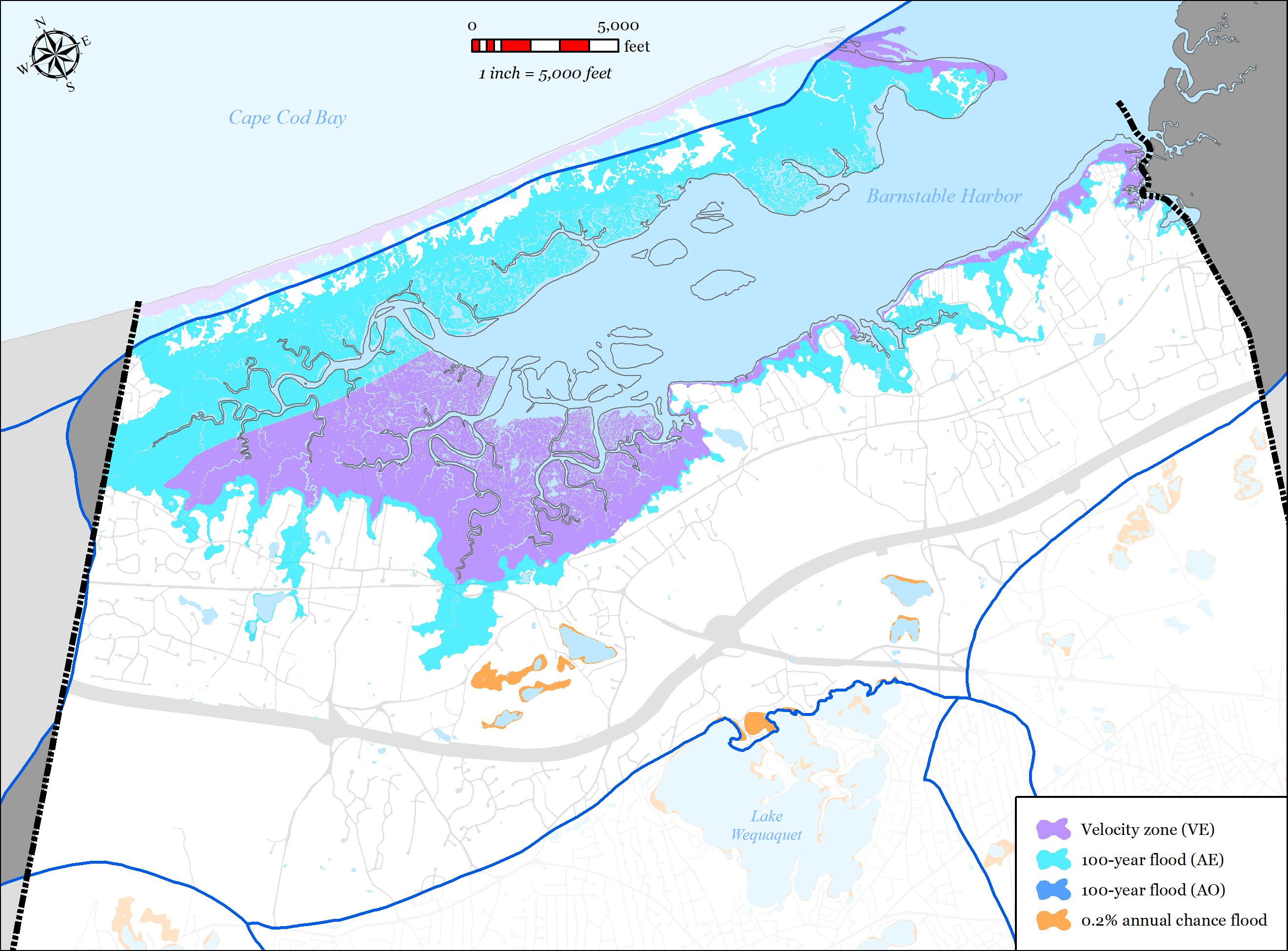
Figure 5-70: FEMA Flood Zones (2014) in Barnstable Harbor Watershed
-
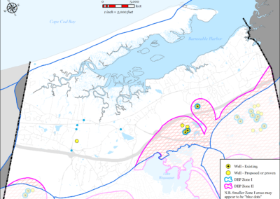
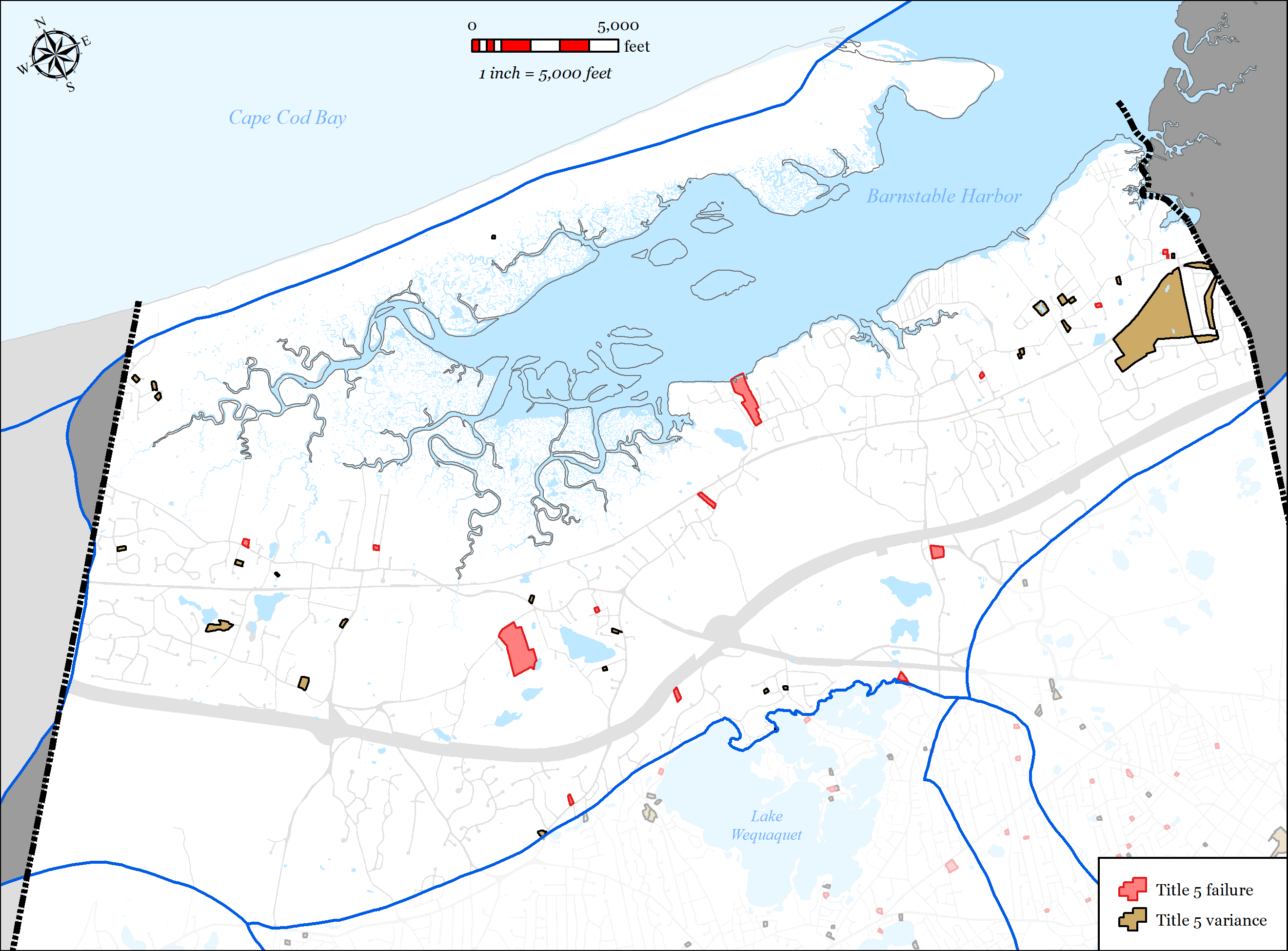
Figure 5-71: Parcels with Title 5 Septic Failures and Variances in Barnstable Harbor Watershed
-
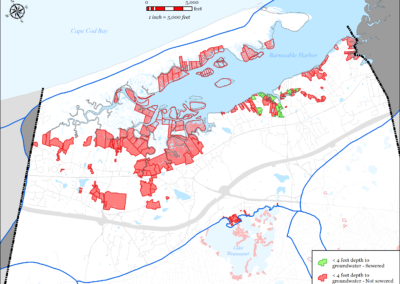
Figure 5-72: Parcels with I/A Septic Systems in Barnstable Harbor Watershed
-
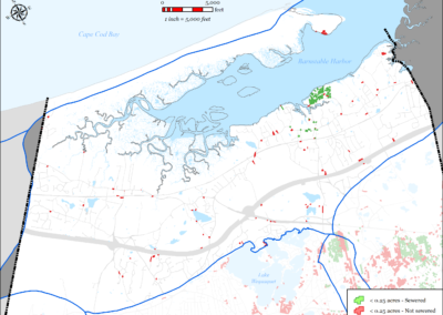
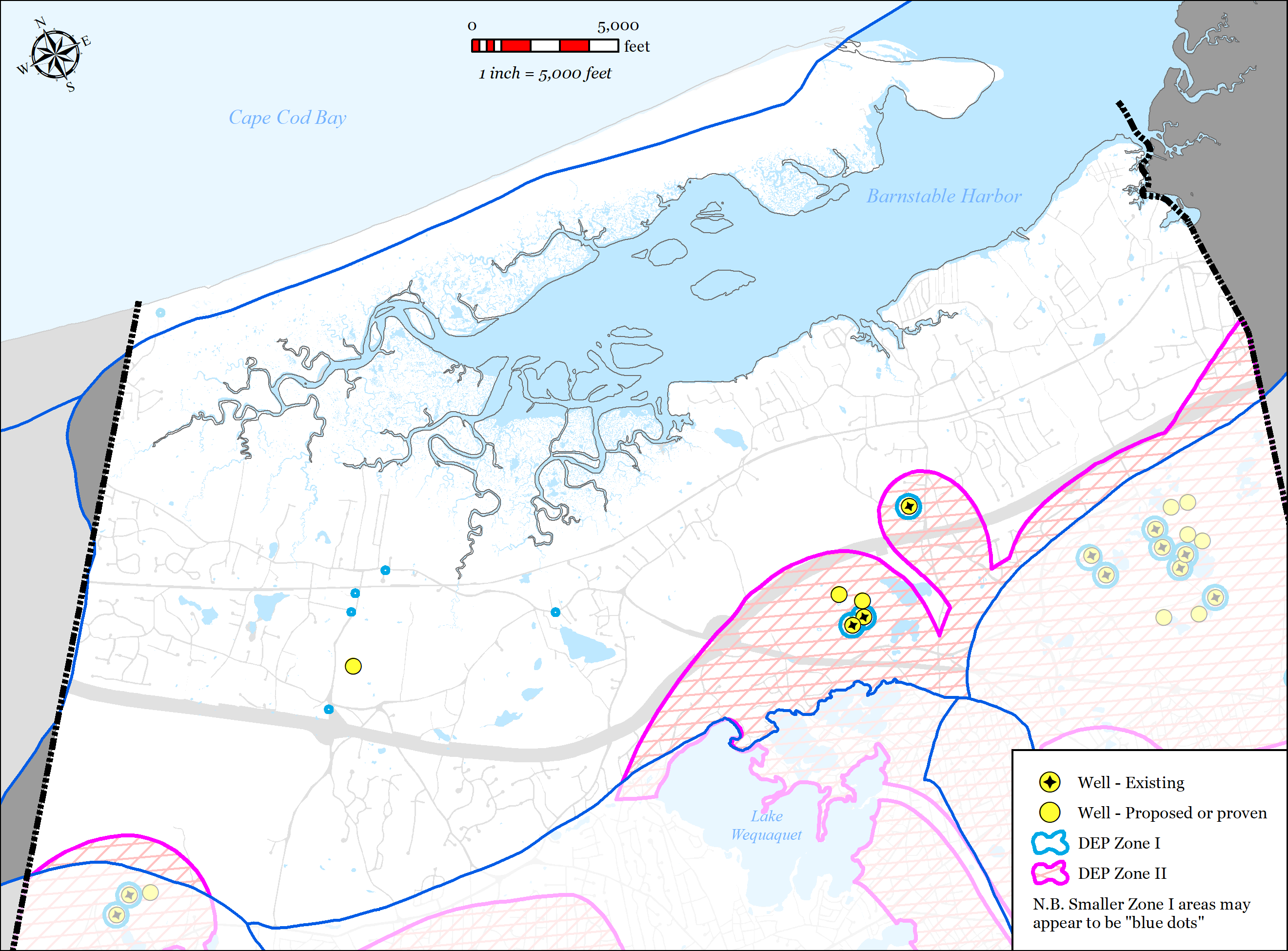
Figure 5-73: Public Water Supply Wells in Barnstable Harbor Watershed
-
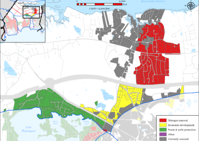
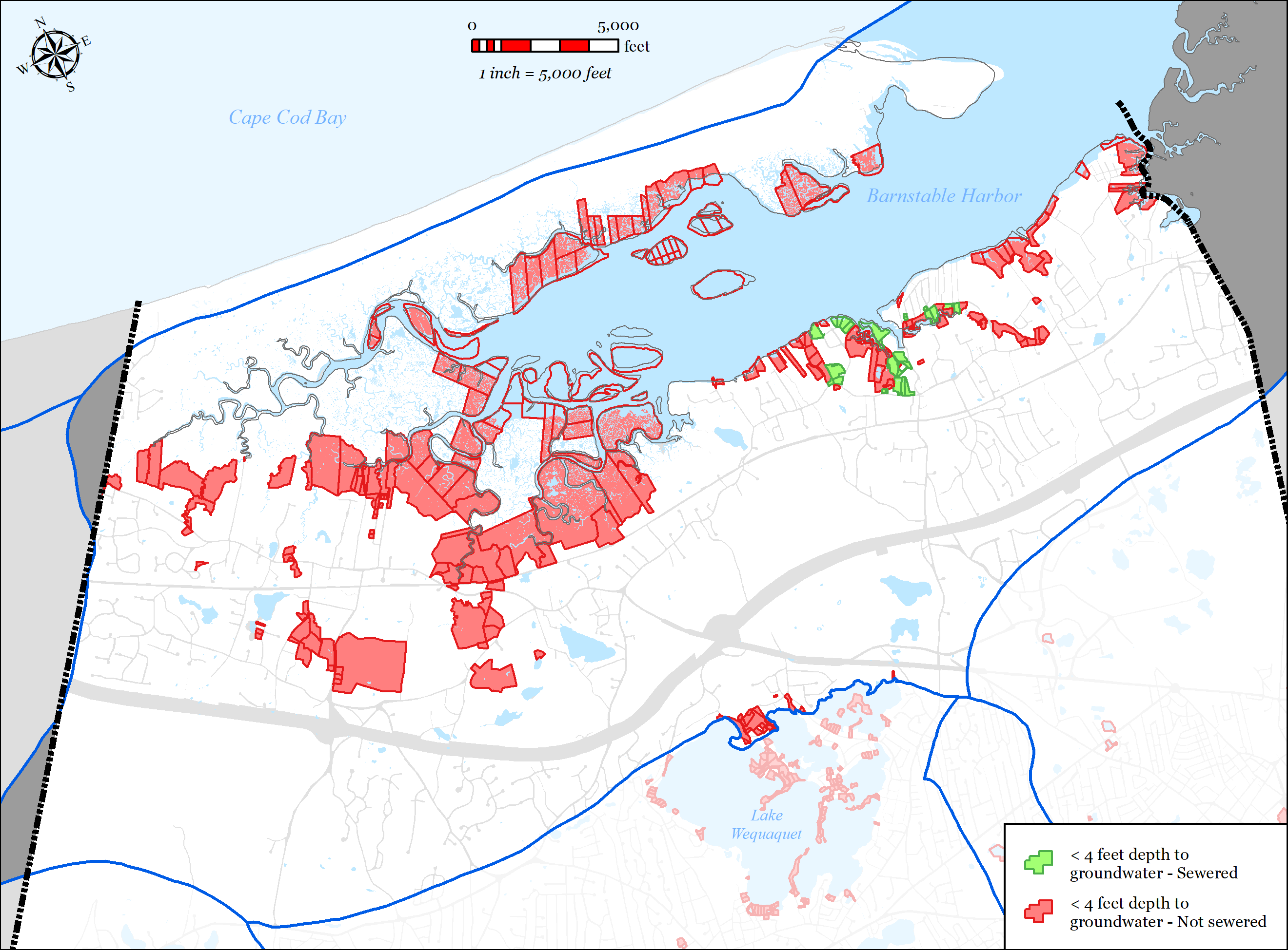
Figure 5-74: Parcels with Less than 4 feet Depth to Groundwater in Barnstable Harbor Watershed
-

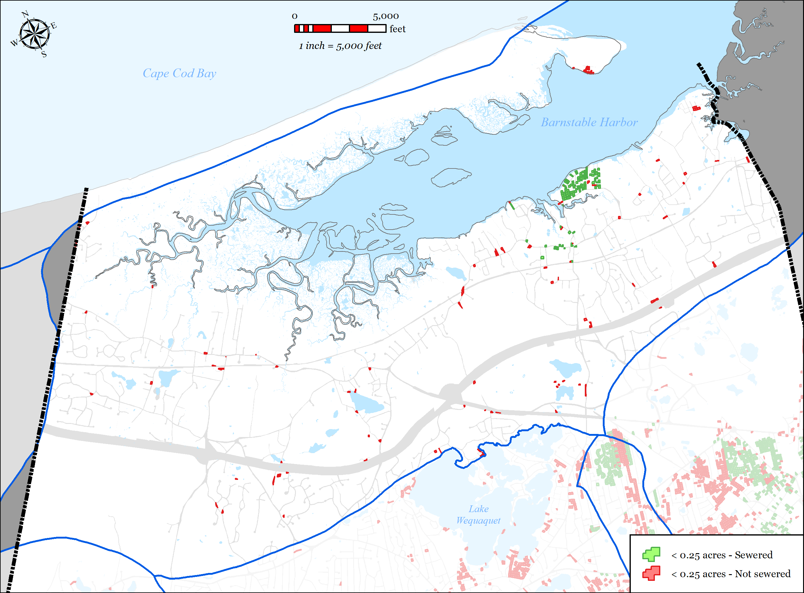
Figure 5-75: Parcels with Less than 0.25 acres in Barnstable Harbor Watershed


5.2.7.1.1 Nutrient Removal
As of the writing of this report, the MEP technical report for the Barnstable Harbor system is in draft form and there is no approved nitrogen TMDL for the Barnstable Harbor system. The 2017 draft MEP technical report for the Barnstable Harbor system indicates that the system is not severely overloaded with respect to nitrogen and the majority of sub-embayments have
Town of Barnstable 5-105 Comprehensive Wastewater Management Plan
assimilative capacity to accept more nitrogen. The one exception is the Millway sub-embayment which the modeling indicates is overloaded with respect to nitrogen and requires a 65% (4.7 kg/day-N) reduction in nitrogen septic load. The Town’s wastewater plan has been designed to exceed the required septic load removal within the Millway sub-embayment by sewer expansion within the Millway sub-watersheds (Millway LT10, Millway GT10, and Maraspin Creek sub- watersheds). Utilizing the Town’s wastewater planning GIS tool, the Town modeled the septic loading within the Millway sub-watersheds and developed a sewer expansion plan to reduce the septic loading to the Millway sub-embayment. The plan will extend sewer to 370 parcels within the Millway sub-watersheds which will result in an un-attenuated septic load removal of 5.3 kg/day-N, which exceeds the MEP required reduction of 4.7 kg/day-N.
5.2.7.1.2 Wastewater Needs (Other Needs)
Title 5 Issues
Integral to the planning process was the Town’s development a wastewater planning GIS tool which allowed Town staff to spatially map traditional Title 5 concerns such as small lot size, depth to groundwater, existing septic variances, existing known failed septic systems, and systems within Zone IIs. Parcels with area less than 0.25 acres were flagged because they were considered difficult to site a traditional septic system, likely to need septic variances, and increased density leading to increased nutrient loading. Parcels with an average depth of groundwater of less than four feet were flagged as likely to require raised systems which are costly and less desirable for community aesthetics. Existing septic variances and existing known failed septic systems were also mapped.
The tool allows the Town to overlay these layers to identify the “hot-spots” for traditional Title 5 concerns. These areas were then incorporated into the plan where practical. Many of these “hot- spots” overlaid other needs such as nutrients and pond protection. The Plan for the Barnstable Harbor Watershed addresses traditional Title 5 concerns as shown in the data presented below which was calculated using the Town’s wastewater planning GIS tool (this data does not account for attenuated nitrogen data):
- Total parcels within the Town of Barnstable within the Barnstable Harbor Watershed = 4,656
- Total parcels connected to municipal existing sewer = 452 (10%)
- Parcels with total area less than 0.25 acres = 335 (7%)
o 139 (41%) already served by municipal sewer
o 38 (11%) additional to be addressed with a traditional solution in the Plan o Total = 177 (52%)
Parcels with average depth to groundwater less than four feet = 267 (6%)
Town of Barnstable 5-106 Comprehensive Wastewater Management Plan
o 29 (11%) already served by municipal sewer
o 36 (13%) additional to be addressed with a traditional solution in the Plan o Total = 65 (24%)
Parcels with septic system variances = 26 (0.6%)
o 5 (19%) will be addressed with a traditional solution in the Plan
Parcels with known failed septic systems = 2 (0.04%)
o 1 (50%) will be addressed with a traditional solution in the Plan
Parcels located within a Zone II = 669 (14%)
o 40 (6%) already served by municipal sewer
o 382 (57%) additional to be addressed with a traditional solution in the Plan o Total = 422 (63%)
Flood Zones
- Total parcels within the Barnstable Harbor Watershed = 5,220
- Parcels within FEMA mapped 100-year flood zone (AE/AO) or velocity zone (VE) =833
o 179 (21%) already served by municipal sewer
o 24 (3%) that will be addressed with a traditional solution in the Plan o Total = 203 (24%)
Contaminants of Emerging Concern (CEcs)
Contaminants of emerging concern (CECs) are increasingly being detected in surface water.
(CECs) are made up of three general groups, endocrine disrupting compounds, pharmaceuticals, and personal care products. These compounds and potential contaminants are not currently regulated by the federal government because their toxicity is not well understood. Collecting wastewater with sewers and treating at a centralized treatment location allows the opportunity to treat wastewater for CECs as they are better understood and future treatment technologies are developed.
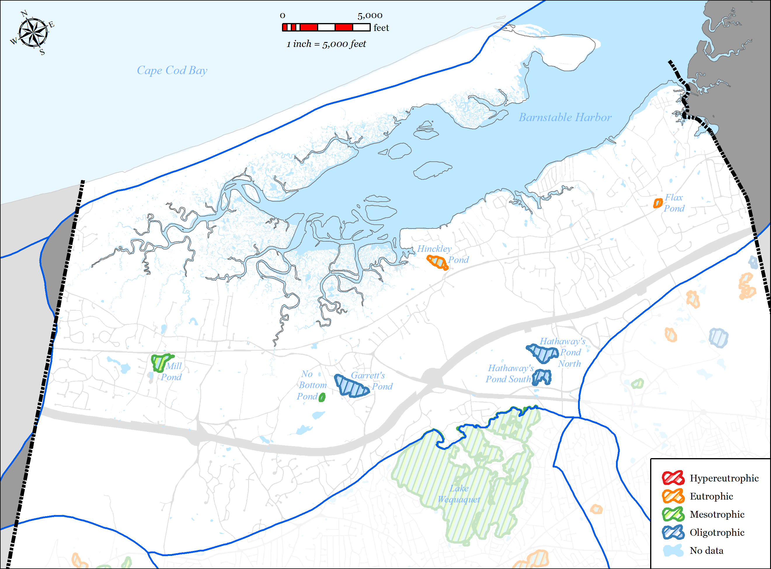
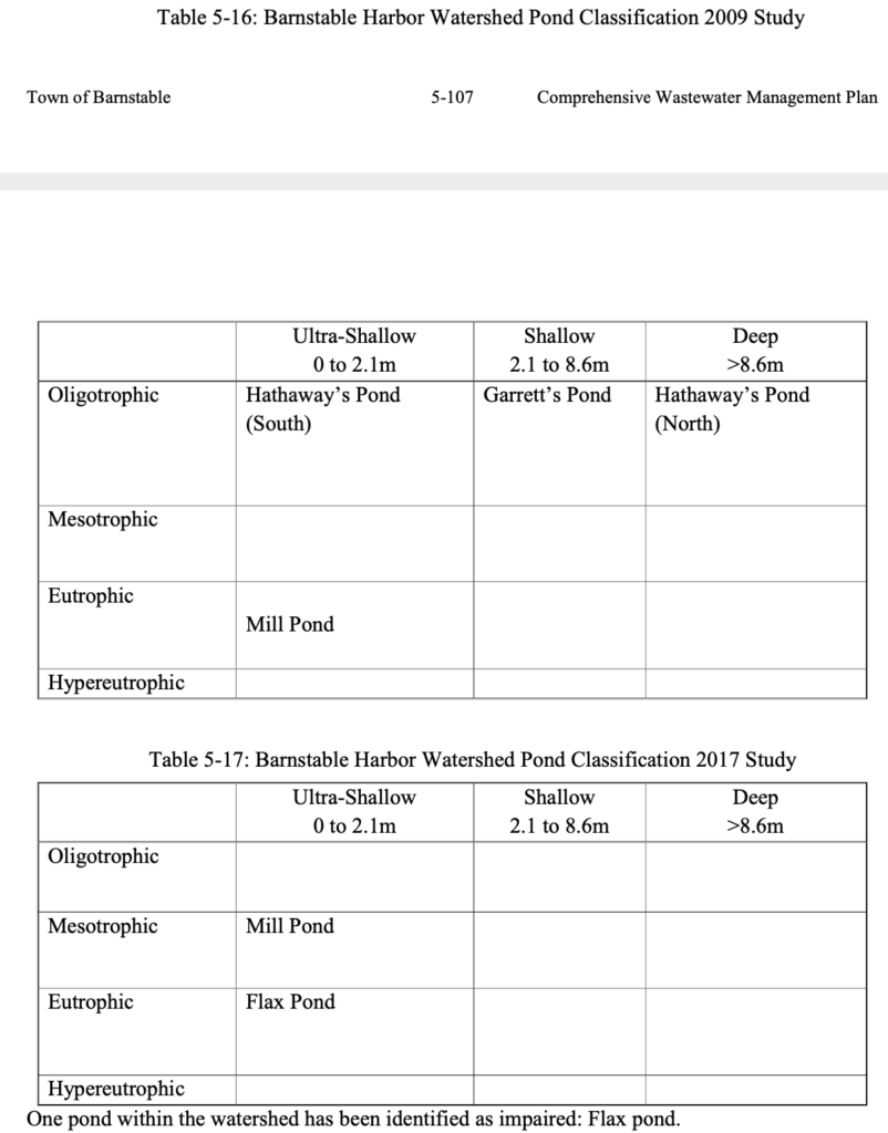
5.2.7.1.3 Pond Protection
The Town’s wastewater planning has included detailed studies of ponds 3 acres or larger throughout the Town. Through those studies, there is extensive water data for 5 ponds in the Barnstable Harbor Watershed. Pond classification of these ponds is shown in Table 5-16 and Table 5-17. Two ponds within the watershed have been identified as impaired: Flax Pond and Mill Pond.
Economic Development
The Town’s Planning and Development Department (P&D) identified a number of areas within the Barnstable Watershed as needs areas for sewer expansion to promote economic development. These areas include:
- Properties along Route 132 from Attucks Lane to Phinney’s Lane.
- Properties along Attucks Lane
- Properties along the west side of Phinney’s Lane between Route 132 and the Mid-Cape Highway (Route 6).
- The Kidd’s Hill Area (referred to in previous sections as the “Lorusso property”).
- Properties in the “Independence Park” area that have not been connected to municipal sewer to date or have not been developed to date.
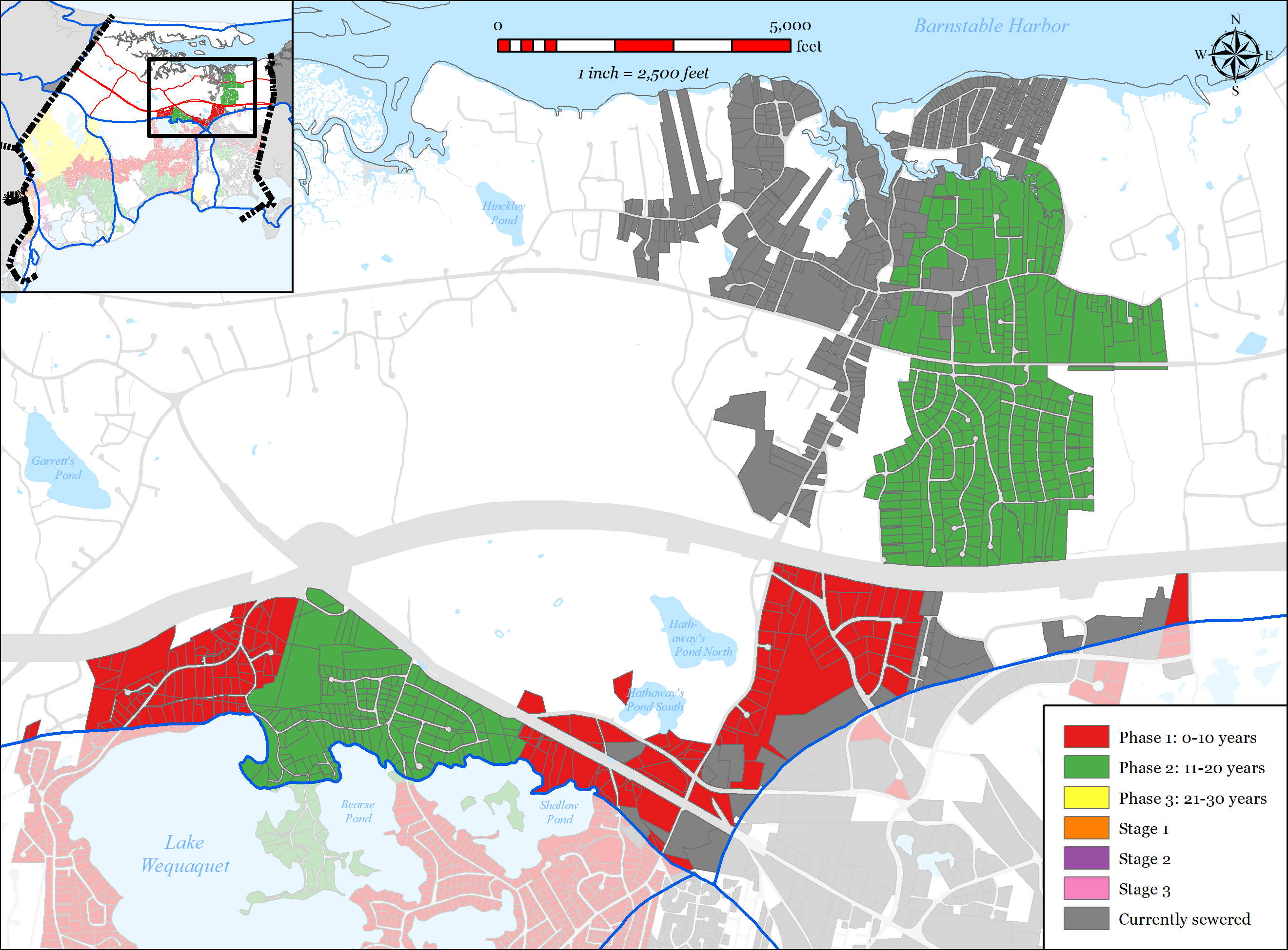
5.2.7.2 PROPOSED SOLUTIONS
The plan addresses the needs areas using the following techniques:
Sewer Expansion
o 452 of the 4,656 parcels (10%) in the watershed within the Town of Barnstable are connected to municipal sewer
o 370 parcels in the Millway sub-watersheds will be are included in the proposed sewer expansion plan. The un-attenuated septic load removal is 5.3 kg/day-N, which exceeds the MEP required reduction of 4.7 kg/day-N.
Stormwater upgrades
o The Town’s MS4 program will identify and provide solutions to existing stormwater outfalls.
54 of the Town’s 207 identified stormwater outfalls are located in the
Barnstable Harbor Watershed.
o The Town’s Public Road program invests on average $750,000 a year in stormwater improvements in the Town’s public roads. These improvements generally include replacement of failed catch basins and leaching structures.
o In the Fall of 2019 and the Spring of 2020, the Town will be completing a streetscape project on Route 6A the center of Barnstable Village and on Mill Way which includes an upgrade to the stormwater management systems of these roadways. These upgrades will improve the water quality of the stormwater runoff generated on these roadways and collected in the stormwater system.
Fertilizer Regulation
o In 2014 the Town adopted a Fertilizer Nitrogen and Phosphorus Control
Regulation (see Appendix PP). The regulation includes the following:
Provides Best Management Practices and performance standards for noncertified fertilizer applicators.
Outlines education, certification, enforcement and penalties.
Town of Barnstable 5-109 Comprehensive Wastewater Management Plan
5.2.7.3 FUTURE CONDITIONS
The plan accommodates future growth conditions as follows:
- The Millway sub-watershed is significantly developed with predominantly residential uses. It is not anticipated that there will be substantial growth within this sub-watershed. However, sewer expansion within this sub-watershed has been designed to remove 113% of the required septic load to accommodate any unanticipated growth within this area. Sewer expansion projects will be designed to accommodate growth within the expansion areas (increased pipe sizes, appropriate pump station sizing, etc.).
- Downtown Barnstable Village is a densely developed business center and is also home to the Barnstable County complex. This area has been served by municipal sewer since the late 1970s.
o The SewerCAD model indicates that the existing sewers in this area have sufficient capacity for existing and future conditions.
- Adaptive management and monitoring
o The Town will continue to monitor the embayment, review the Plan and provide formal updates as required.
o Refer to Section 6.4 for the Adaptive Management Plan and Section 6.3 for the Monitoring Plan.