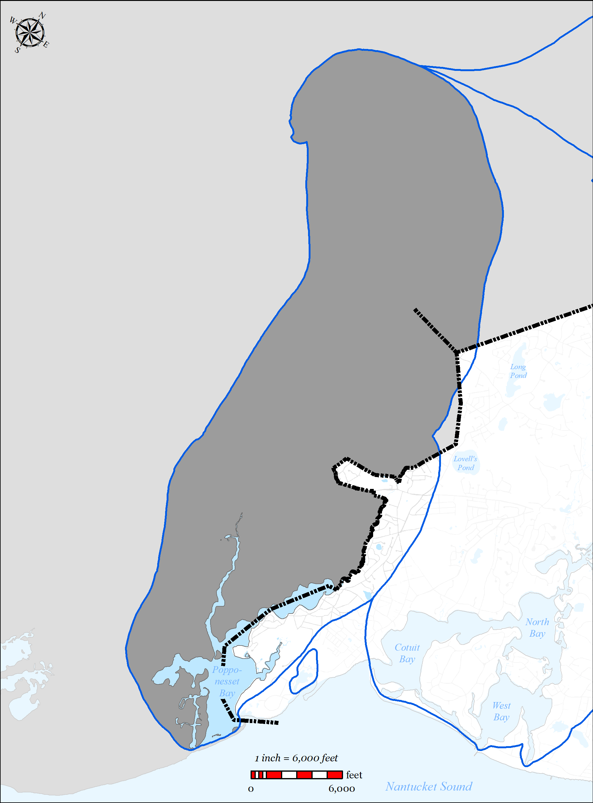
The Popponesset Bay system is located within the Towns of Mashpee (north and west) and Barnstable (east), with a southern shore bounded by water from Nantucket Sound. The Bay is separated from Nantucket Sound by a barrier spit (Popponesset Beach), which grew from the southwestern shore. The Bay exchanges tidal water with Nantucket Sound through a single maintained inlet. Refer to Figure 5-56 for a figure showing the Popponesset Bay system. For a detailed description of the embayment system, refer to the 2004 MEP Report for the Popponesset Bay Embayment (Appendix T).
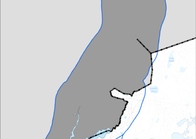
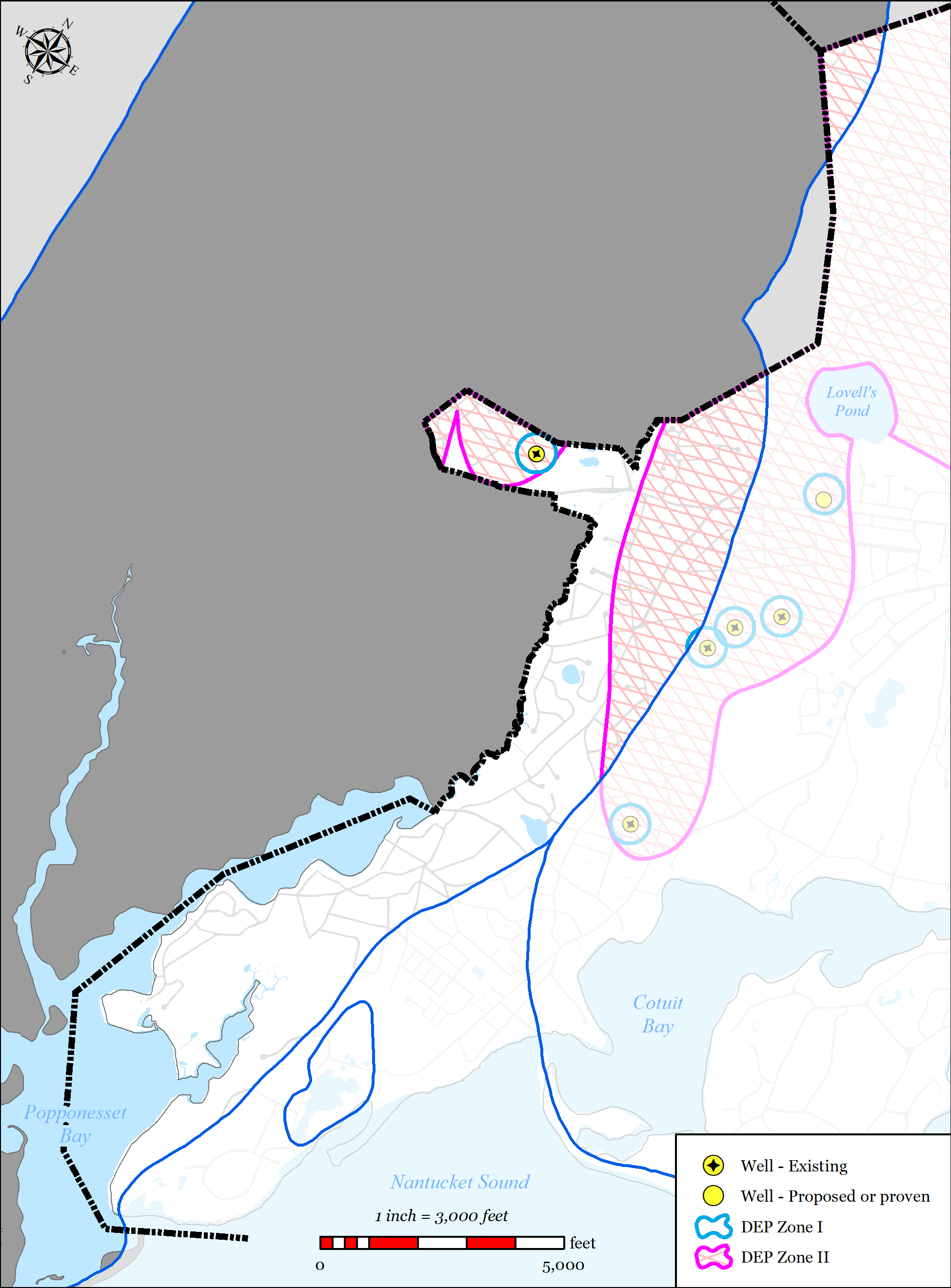
The source water for the Popponesset Bay Embayment System is the Popponesset Bay Watershed. The Popponesset Bay Watershed is approximately 13,082 acres and is distributed among the Towns of Mashpee, Barnstable and Sandwich (see Figure 5-56). Within the watershed there are 40 identified surface waters including 13 named freshwater ponds (including No Bottom Pond, Lewis Pond, Naomi Pond which are located in the Town of Barnstable) and 2 significant freshwater stream outlets (Mashpee River and Santuit River). The Cotuit Water District operates one public drinking water well located within the watershed within the limits of the Town of Barnstable.
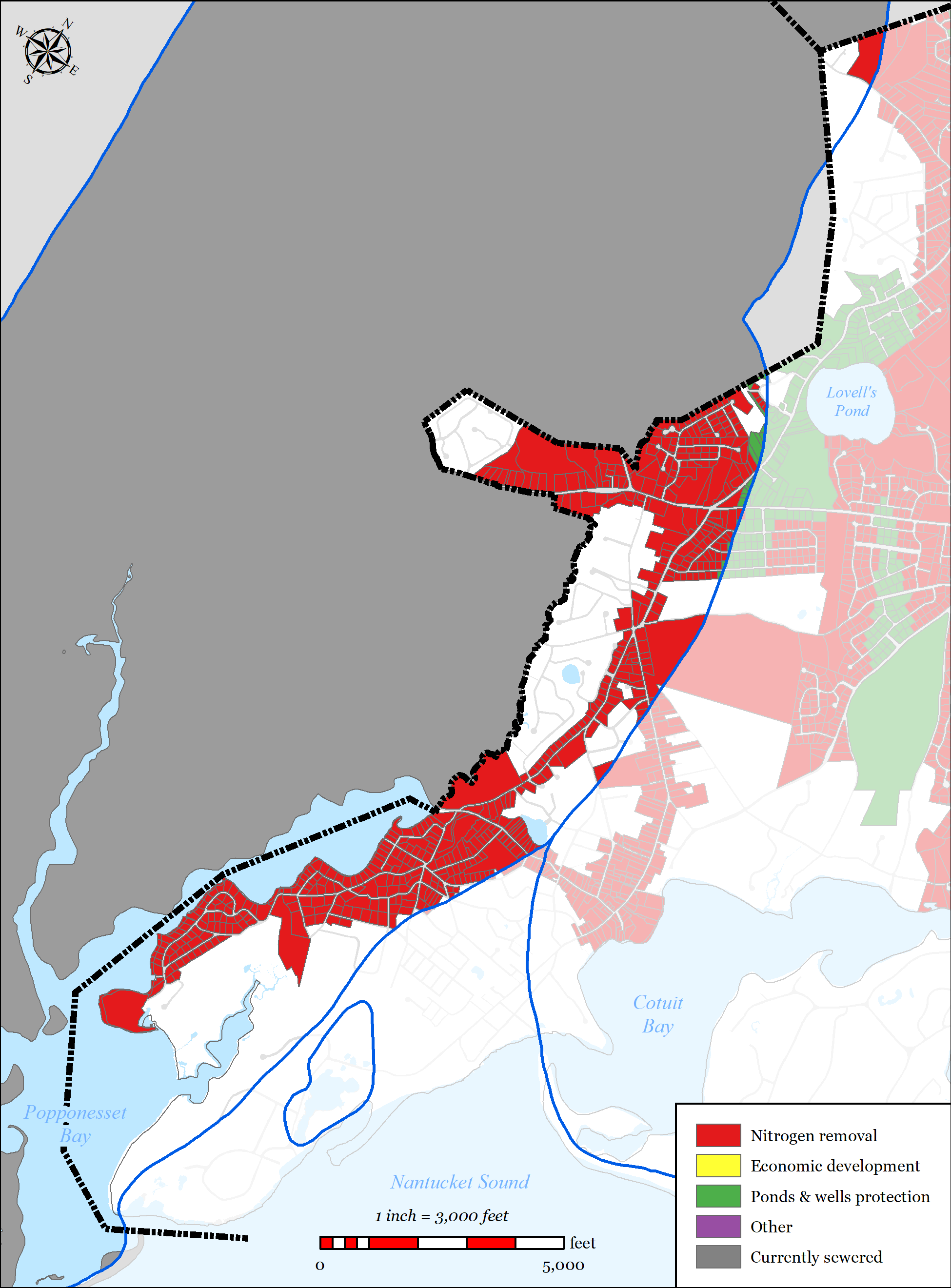
The Town of Barnstable’s wastewater plan has been designed to address multiple needs areas within the Popponesset Bay Watershed, including nutrient removal, pond protection, flood zone considerations, and economic development, via sewer expansion into the Popponesset Bay Watershed.
5.2.6.1 SUMMARY OF NEEDS
The Town of Barnstable’s wastewater plan has been designed to address multiple needs areas within the Popponesset Bay Watershed, including nutrient removal, pond protection, water supply protection, flood zone considerations, and economic development, via sewer expansion within the Popponesset Bay Watershed.
-
CWMP Figure 5-54 PB full watershed
-
CWMP Figure 5-55 PB mep-modeled existing septic load removal
-

Figure 5-56: Popponesset Bay Watershed Boundary
-
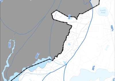
Figure 5-57: MEP-modeled Existing Septic Removal in Watershed
-
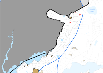
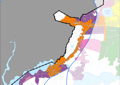
Figure 5-58: MEP-modeled Future Septic Removal in Watershed
-
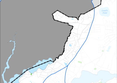
Figure 5-59: FEMA Flood Zones (2014) in Popponesset Bay Watershed
-
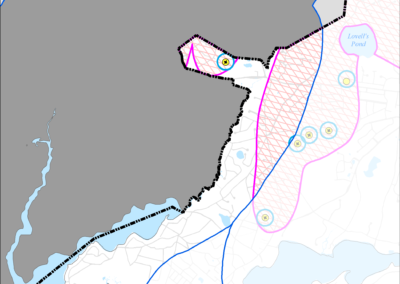
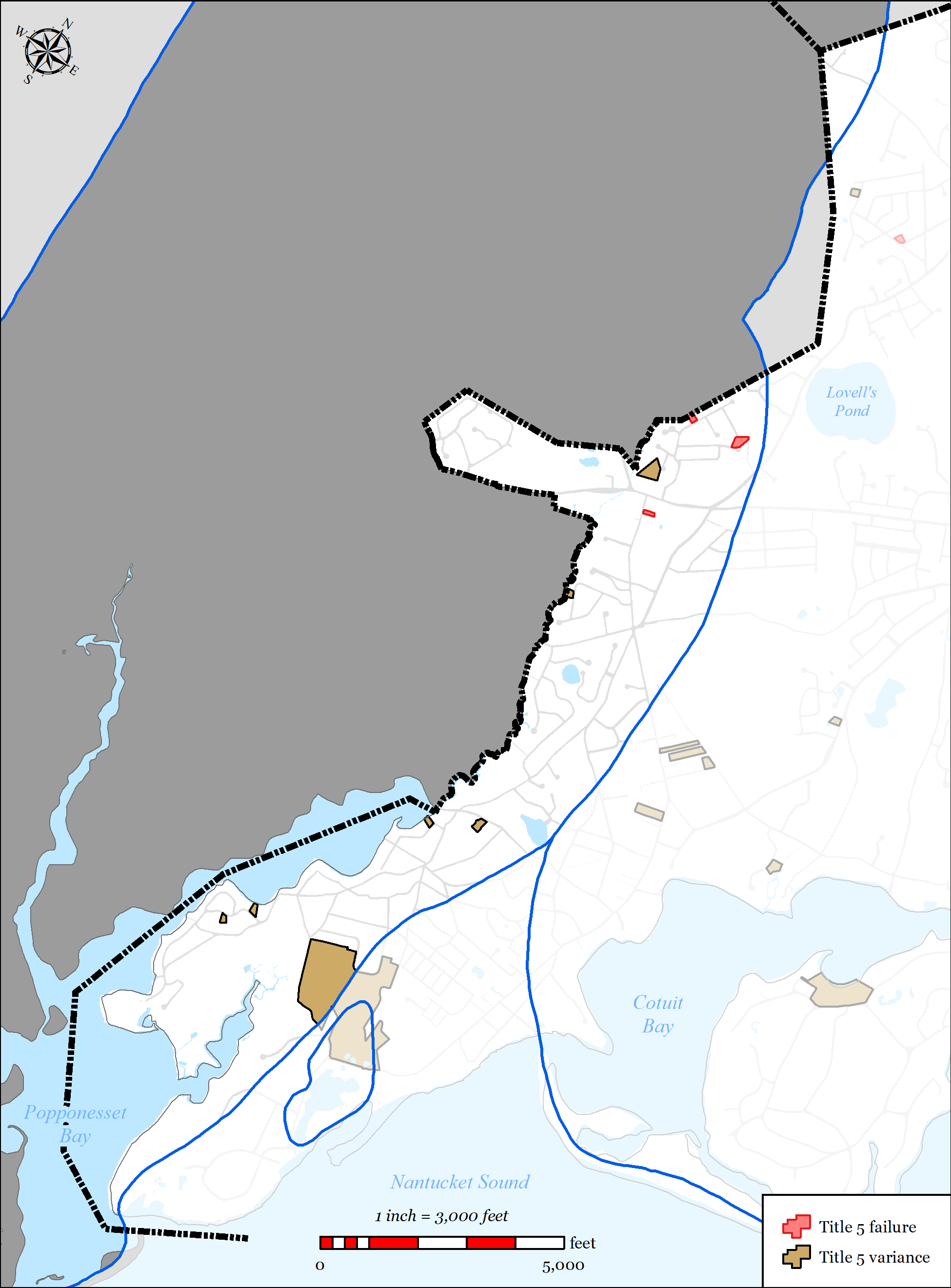
Figure 5-60: Parcels with Title 5 Septic Failures and Variances in Popponesset Bay Watershed
-
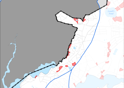
Figure 5-61: Parcels with I/A Septic Systems in Popponesset Bay Watershed
-
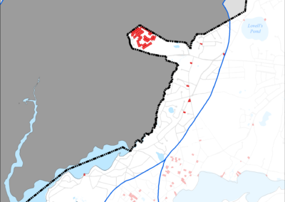
Figure 5-62: Public Water Supply Wells in Popponesset Bay Watershed
-
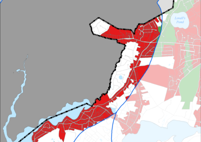
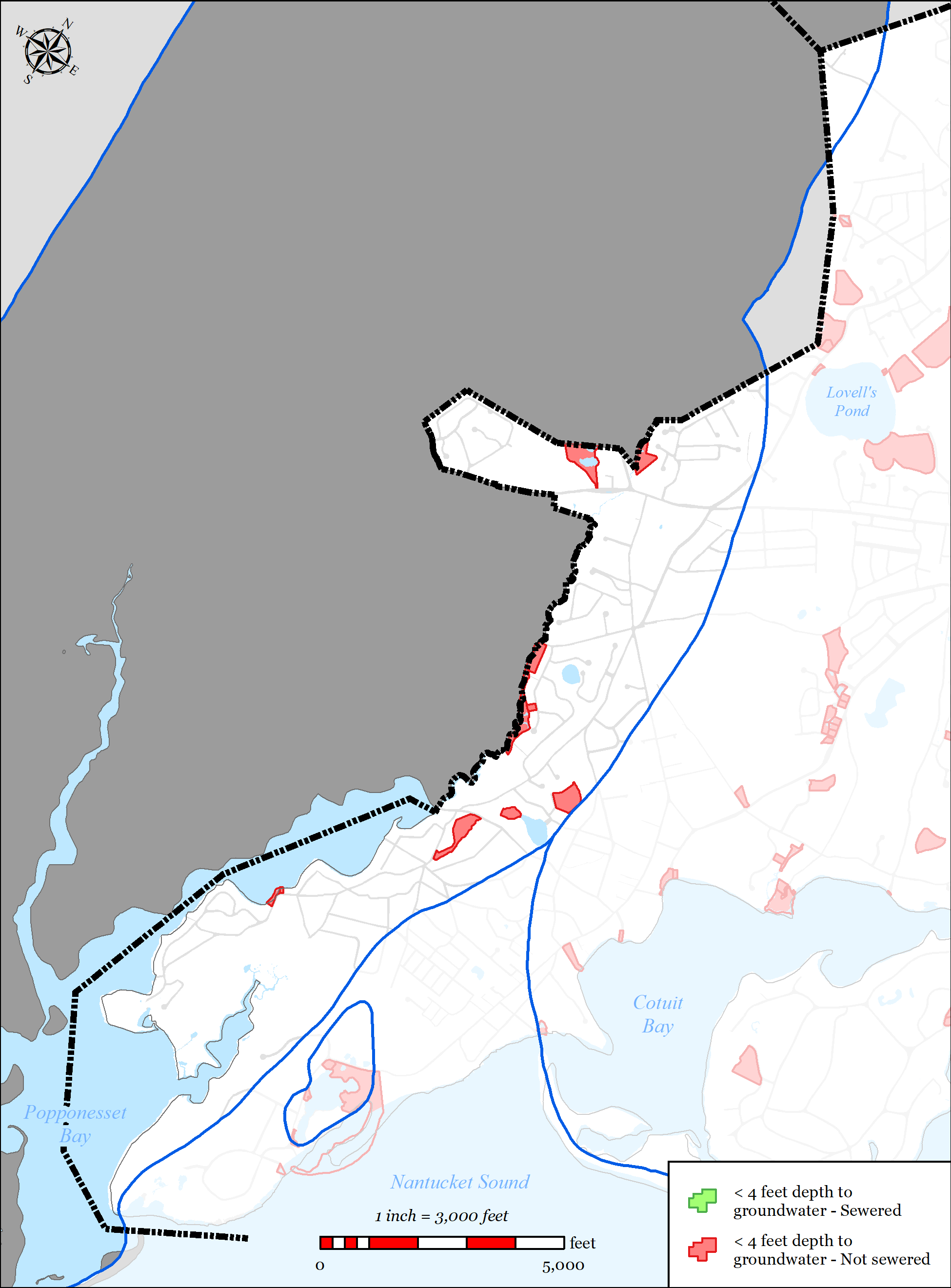
Figure 5-63: Parcels with Less than 4 feet Depth to Groundwater in Popponesset Bay Watershed
-
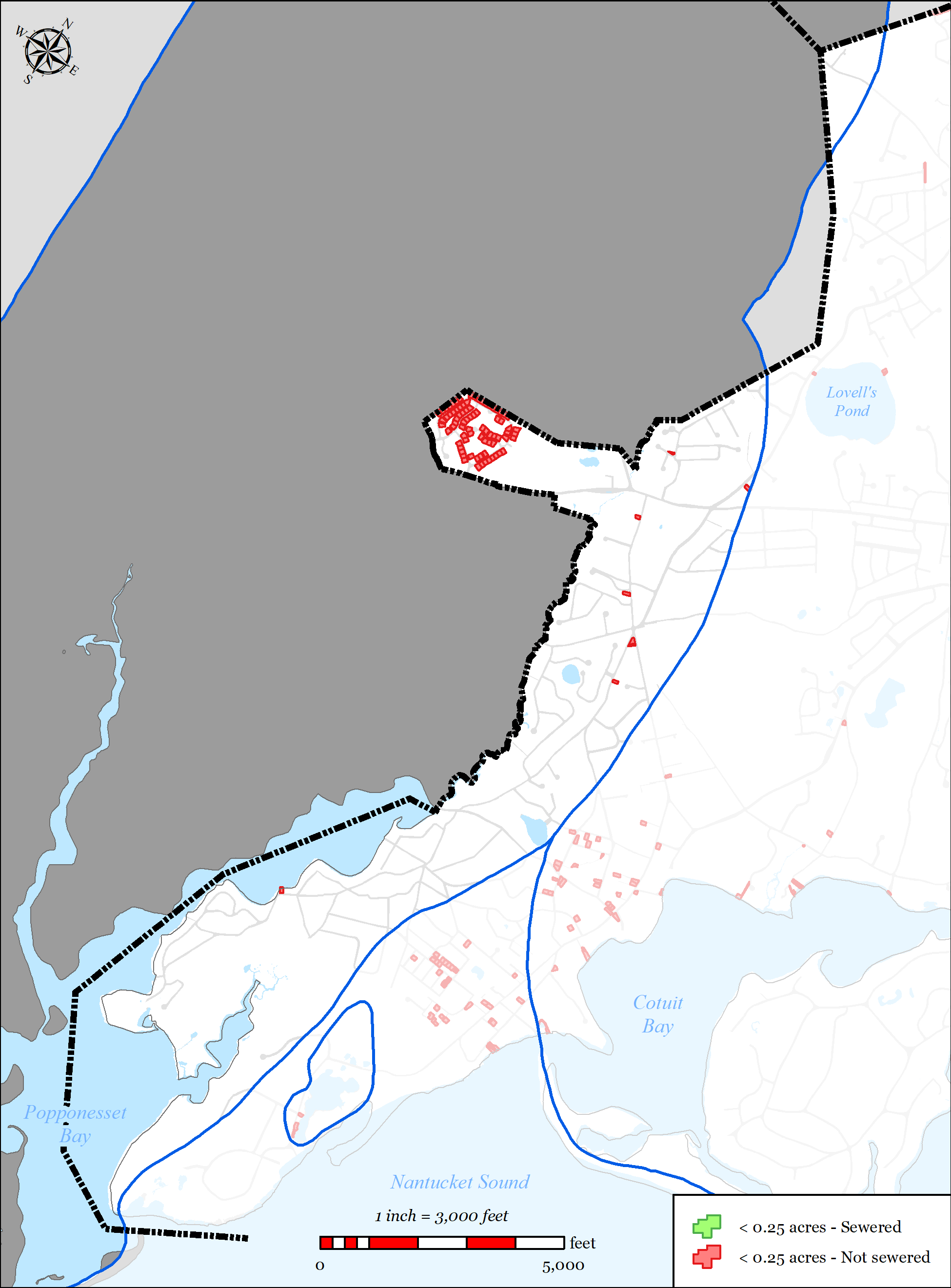
igure 5-64: Parcels with Less than 0.25 acres in Popponesset Bay Watershed


5.2.6.1.1 Nutrient Removal
The 2004 MEP technical report for the Popponesset Bay system indicates that the system exceeds its critical threshold for nitrogen, resulting in impaired water quality. Based upon the findings of the MEP technical report, a TMDL for nitrogen has been developed and approved.
As previously discussed in Section 2.3.1.1, the Town executed an IMA with its western neighbors (Mashpee and Sandwich) relative to addressing nitrogen removal (via nitrogen sharing or other similar methods) in the Popponesset Bay Watershed. Key components of the IMA include:
Town of Barnstable 5-87 Comprehensive Wastewater Management Plan
- The Towns agreed that it was in their best interests to apply jointly for a Watershed Permit.
- That each Town would develop and implement its own MassDEP approved CWMP or Targeted Watershed Management Plan, and the capital projects undertaken by the Town as a result of those plans will be the sole responsibility of that Town.
- The Town of Mashpee would serve as the fiscal agent under the IMA and, as such, will receive, hold, and expend any funds appropriated by the Parties for joint actions required in the implementation of the IMA, as well as any grant funds awarded to the Parties for the purpose of pursuing, securing, and implementing a Permit.
- The Towns would establish a Popponesset Bay Watershed Work Group, which would be comprised of three members from each Town (Town Manager, Selectman/Town Councilor, and a technical representative), and which will:
o Administer this IMA and any amendments to it;
o Administer the application and implementation of a Watershed Permit; but o The Work Group has no authority to bind one or more of the parties.
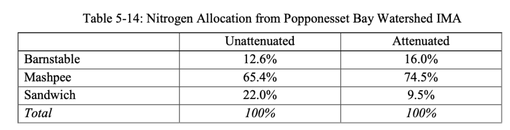
The Towns established a nitrogen allocation formula for the purpose of assigning costs (see Table 5-14). They further agreed that the costs should be allocated on the basis of unattenuated and attenuated nitrogen loadings.
Barnstable Mashpee Sandwich Total
The unattenuated loads for tracking and accounting of nitrogen reductions which result from implemented measures.
The attenuated loads to provide a benchmark for comparison of improvements to water quality based on implemented measures. Attenuated load is what is received in the estuary.
- The Towns agreed to develop a fair and practical methodology for nitrogen trading mechanism.
- The Towns agreed to work together to adopt a fair and practical methodology for monitoring the water quality of the watershed and funding said effort.
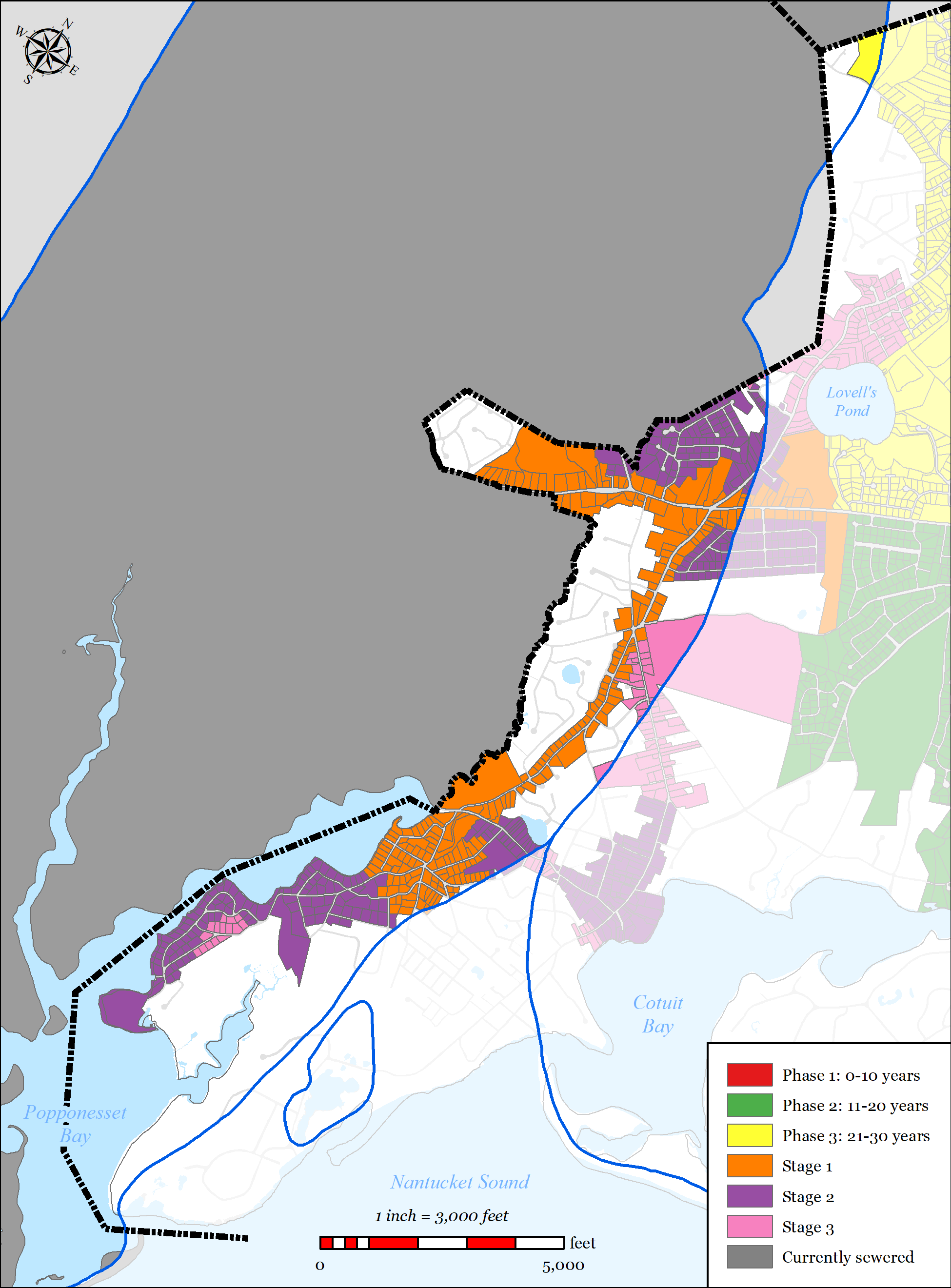
However, since the development of the IMA, concerns have been raised by the community that nitrogen trading would not adequately address deteriorating water quality in portions on the watershed, specifically Shoestring Bay. Once a potential western wastewater treatment and disposal option presented itself (JBCC), the Town decided to fund the evaluation and preliminary design of a traditional solution in the Town’s portion of the Popponesset Bay Watershed. As a result, the Town developed three “stages” of traditional sewer expansion in Cotuit which was designed to address the septic load removal requirements in the Town’s portion of the watershed by traditional methods.
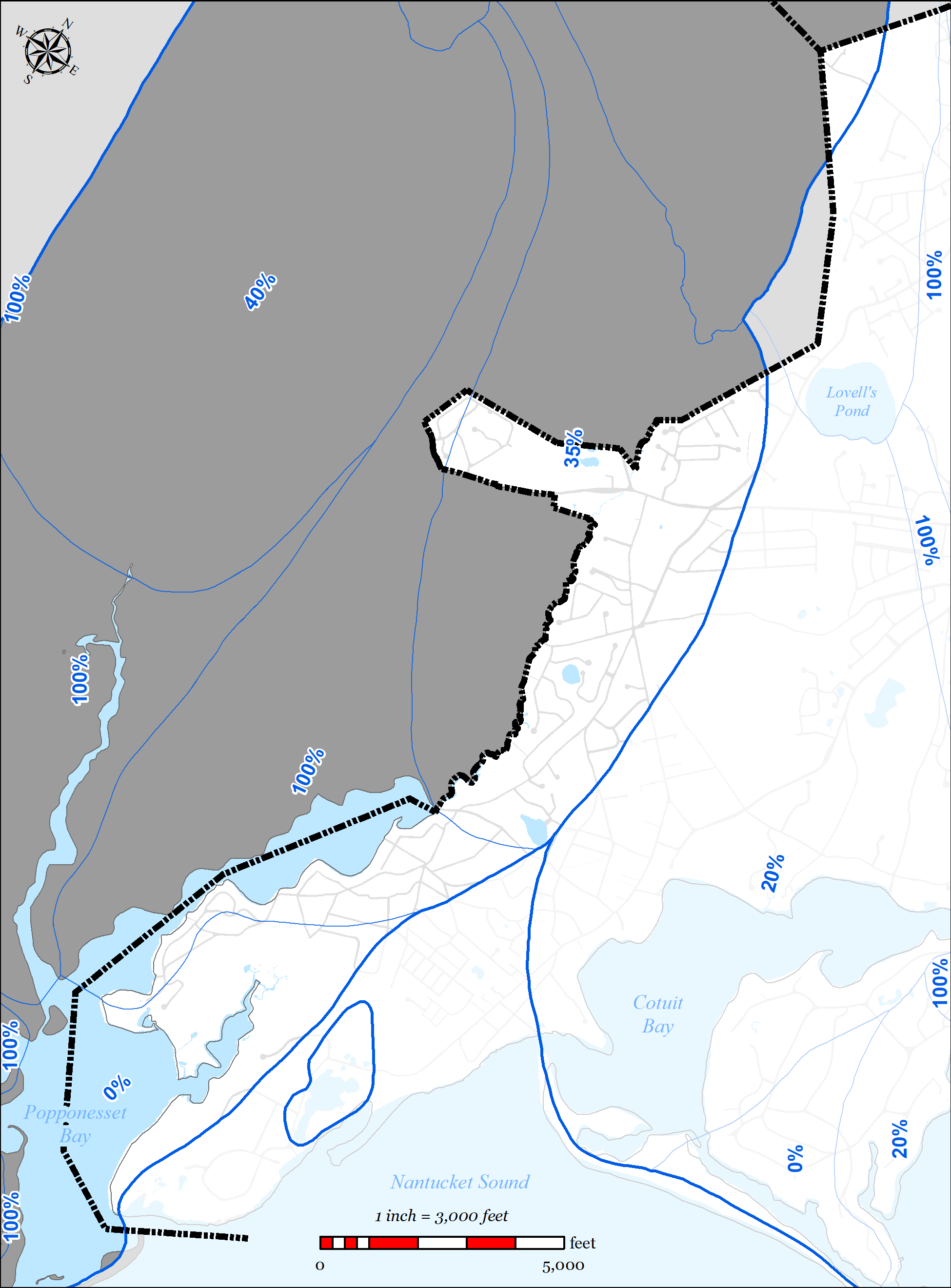
The Town’s wastewater plan has been designed to exceed the septic load removals suggested in the 2004 MEP Report’s threshold loading scenarios. The threshold septic loading scenario calls for a 61% reduction in total septic load within the watershed, which is further broken out into required septic load removals of the sub-watersheds that make up the total watershed. Portions of three of the sub-watershed areas are located within the Town: Santuit River requires 35% septic load removal (4.1 kg/day-N), Shoestring Bay requires 100% septic load removal (6.9 kg/day-N) and Pinquickset Cove requires 0% septic load removal. The aforementioned staging developed by the Town was designed to meet or exceed these percentages within the Town and removes the following total, un-attenuated septic load:
- Santuit River sub-watershed: 44%, (4.1 kg/day-N, un-attenuated)
- Shoestring Bay sub-watershed: 100% (3.4 kg/day-N, un-attenuated)
- Pinquickset Cove sub-watershed: 30% (0.6 kg/day-N, un-attenuated)
It is important to note that the proposed staging sewer expansion plan as designed exceeds the threshold septic load to be removed within the Santuit River sub-watershed (4.1 kg/day-N, un- attenuated) even though the Town makes up approximately half of the total sub-watershed area.
Nitrogen removal data reported above is from the Town of Barnstable’s wastewater planning GIS tool and reflects calculated existing un-attenuated nitrogen loading based upon existing water use data.
5.2.6.1.2 Wastewater Needs (Other Needs)
Title 5 Issues
If the Town pursues the sewer expansion “stages” within the watershed, the plan will address traditional Title 5 concerns via traditional sewer expansion. Utilizing the Town’s wastewater planning GIS tool allowed Town staff to spatially map traditional Title 5 concerns such as small lot size, depth to groundwater, existing septic variances, existing known failed septic systems, and systems within Zone IIs. Parcels with area less than 0.25 acres were flagged because of they were considered difficult to site a traditional septic system, likely to need septic variances, and increased density leading to increased nutrient loading. Parcels with an average depth of groundwater of less than four feet were flagged as likely to require raised systems which are costly and less desirable for community aesthetics. Existing septic variances and existing known failed septic systems were also mapped.
The tool allows the Town to overlay these layers to identify the “hot-spots” for traditional Title 5 concerns. These areas were then incorporated into the plan where practical. Many of these “hot- spots” overlaid other needs such as nutrients and pond protection. The Plan for the Popponesset Bay Watershed significantly address traditional Title 5 concerns as shown in the data presented below which was calculated using the Town’s wastewater planning GIS tool (this data does not account for attenuated nitrogen data):
- Total parcels located within the Popponesset Bay Watershed in the Town = 943
- Parcels with total area less than 0.25 acres = 92
o 5 (5%) will be addressed with a traditional solution in the Staging Plan Parcels with average depth to groundwater less than four feet = 10
o 5 (50%) will be addressed with a traditional solution in the Staging Plan Parcels with septic system variances = 6
o 5 (83%) will be addressed with a traditional solution in the Staging Plan
- Parcels with known failed septic systems = 0
- Parcels located within a Zone II = 412
o 219 (53%) will be addressed with a traditional solution in the Staging Plan
Flood Zones
Low lying areas adjacent to Shoestring Bay, Pinquickset Cove, and Popponesset Bay proper have been identified as needs areas for sewer expansion due to being within the 100 year floodplain and/or the velocity zone, and generally having shallow depth to groundwater. As a result of these conditions, traditional Title 5 septic systems are difficult and costly to site in these areas.
- Total parcels within the Popponesset Bay Watershed = 943
- Parcels within 100 year flood plain and/or velocity zone = 175
o 114 (65%) will be addressed with a traditional solution in the Staging Plan Contaminants of Emerging Concern (CECs)
Contaminants of emerging concern (CECs) are increasingly being detected in surface water.
(CECs) are made up of three general groups, endocrine disrupting compounds, pharmaceuticals, and personal care products. These compounds and potential contaminants are not currently regulated by the federal government because their toxicity is not well understood. Collecting wastewater with sewers and treating at a centralized treatment location allows the opportunity to
Town of Barnstable 5-90 Comprehensive Wastewater Management Plan treat wastewater for CECs as they are better understood and future treatment technologies are developed.
5.2.6.1.3 Pond Protection
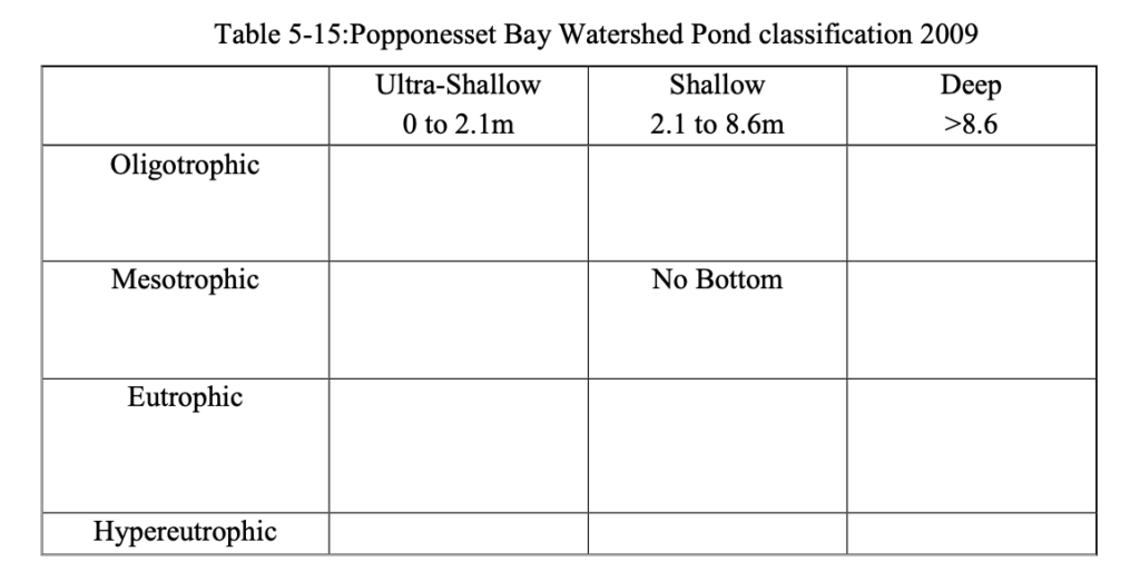
The Town’s wastewater planning has included detailed studies of ponds 3 acres or larger throughout the Town. Through those studies, there is extensive water data for 1 pond in the Popponesset Bay Watershed. Pond classification of these ponds is shown in Table 5-15.
5.2.6.1.4 Economic Development
Within the Popponesset Bay Watershed, the Route 28 corridor has also been identified by the Town as an area where a traditional solution is desired for economic development. Development within this corridor has historically been restricted by wastewater requirements (i.e. Title 5) and the Town’s Salt Water Estuary’s Regulation. The Town’s wastewater plan has included sewer expansion along the entire Route 28 corridor to accommodate these goals.
5.2.6.2 PROPOSED SOLUTIONS
The plan addresses the needs areas using the following techniques:
Sewer expansion
o 524 of the 943 parcels (56%) located in the watershed in the Town are included in the sewer expansion plan
o Removal of 52% (8.4 kg/day-N) of existing un-attenuated septic load within the portions of the watershed within the Town.
Town of Barnstable 5-91 Comprehensive Wastewater Management Plan
5.2.6.3
Popponesset Bay embayment. The majority of the navigational channels within Popponesset are located within the Town of Mashpee’s jurisdiction. The Town of Mashpee performs on-going maintenance dredging within the embayment. The 2004 MEP report modeled a dredging alternative within the embayment which showed negligible impacts on nutrients in the embayment.
Fertilizer Regulation
o In 2014 the Town adopted a Fertilizer Nitrogen and Phosphorus Control
Regulation (see Appendix PP). The regulation includes the following:
- Provides Best Management Practices and performance standards for noncertified fertilizer applicators.
- Outlines education, certification, enforcement and penalties.
Watershed Permit
o As stated in the executed IMA, Barnstable will work with the two other communities (Mashpee and Sandwich) that make up the Popponesset Bay Watershed in the pursuit of a Watershed Permit.FUTURE CONDITIONS
Stormwater upgrades
o The Town’s MS4 program will identify and provide solutions to existing stormwater outfalls.
1 of the Town’s 207 identified stormwater outfalls is located in the
Popponesset Bay Watershed.
o The Town’s Public Road program invests on average $750,000 a year in stormwater improvements in the Town’s public roads. These improvements generally include replacement of failed catch basins and leaching structures.
As part of a project that, partnering with the Town of Mashpee, will replace the culvert which conveys Santuit River (a significant freshwater tributary to Popponesset Bay Watershed) under Old Kings Road, the Town will be installing new stormwater infrastructure which will address stormwater runoff that is discharging directly into the river. This new stormwater system will include deep sump catch basins and infiltration structures which will reduce total suspended solids, bacteria and to a lesser extent nutrients directly discharging to the River.
Dredging
o The Town is not proposing any dredging within the Town’s portion of the
The plan accommodates future growth conditions as follows:
Town of Barnstable 5-92 Comprehensive Wastewater Management Plan
- The majority of the watershed is significantly built-out.
- Projected growth within the watershed.
o The projected growth within the watershed is focused on the Route 28 corridor which will be addressed with traditional solutions (i.e. sewer expansion). Projected growth in these areas will be considered when sizing sewer infrastructure (pipes, pump stations, force mains, etc.).
o New developments within the watershed would be required to connect to sewer.
- The sewer expansion staging plan removes more septic load than required within the watershed, specifically within the Santuit River sub-watershed and the Pinquickset Cove sub-watershed to substantially address any additional development that may be experienced in the watershed.
- Adaptive management and monitoring:
o The Town will continue to monitor the embayment, review the Plan and provide formal updates as required.
o Refer to Section 6.4 for the Adaptive Management Plan and Section 6.3 for the Monitoring Plan.


