
Comprehensive Wastewater Plan (CWMP)
The Halls Creek system is located within the Town of Barnstable with a southern shore bounded by Nantucket Sound. The Halls Creek estuary system is located to the west of the Lewis Bay embayment system. The 2008 Lewis Bay Embayment System MEP Report analyzes the Halls Creek system the nutrient capacity of the Halls Creek System. The estuarine system is separated from Nantucket Sound by Squaw Island and the system exchanges tidal water with Nantucket Sound through a single inlet. For a detailed description of the embayment system, refer to the 2008 MEP Report for the Lewis Bay Embayment System (Appendix AA).
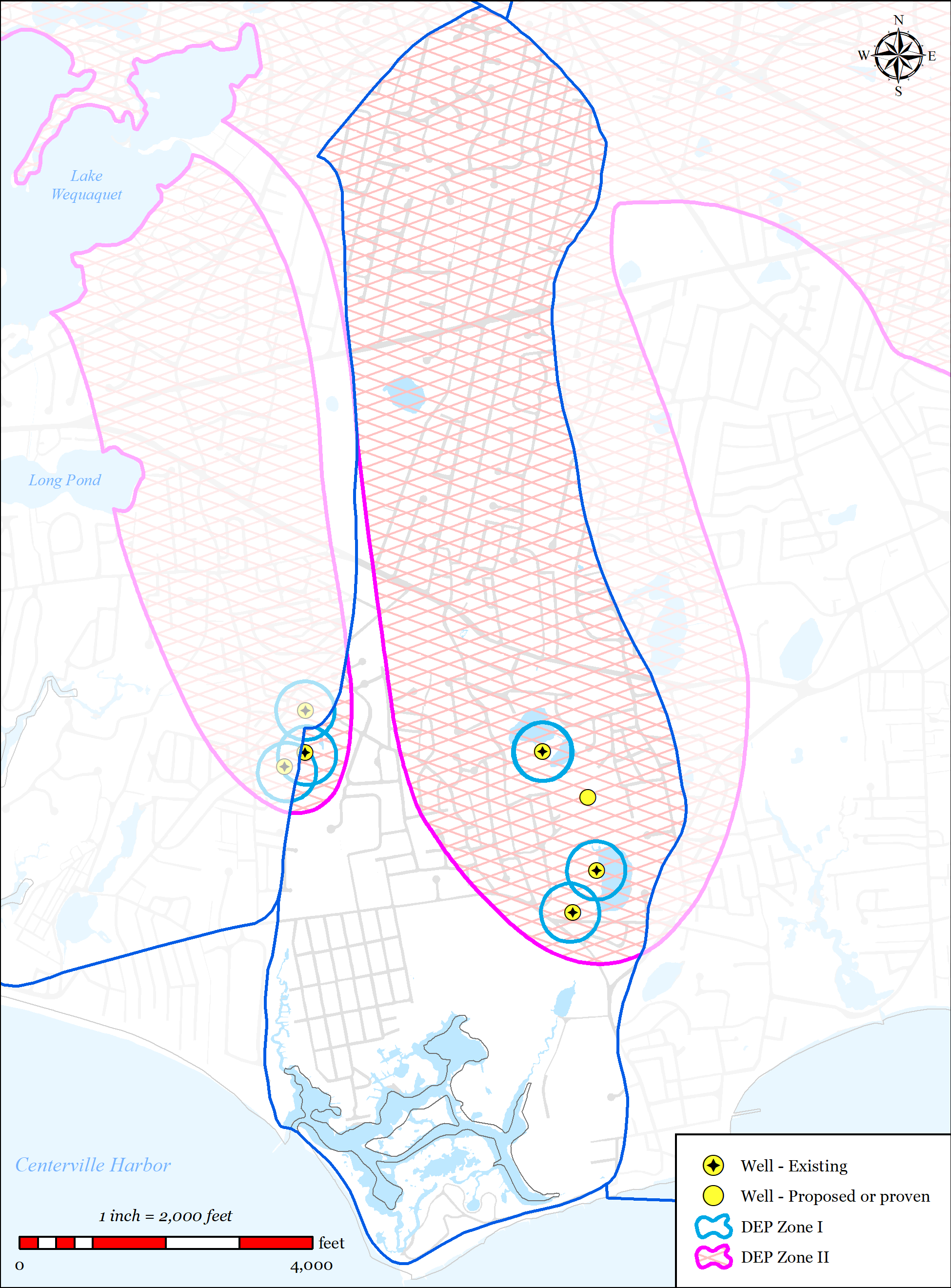
The source water for the Halls Creek system is the Halls Creek Watershed. The Halls Creek Watershed is located entirely within the Town of Barnstable (see Figure 5-14). Within the watershed there are 4 named freshwater ponds (Marchant Pond, Simmons Pond, Ben’s Pond, and Dunn’s Pond). The Hyannis Water District operates three public drinking water wells that are located within the watershed and Centerville Osterville Marstons Mills (COMM) Water District operates one public drinking water well located on the western border of the watershed.
A large section of the upper reaches of the watershed is already served by municipal sewer. The 2008 MEP Model has shown that the Halls Creek system has an assimilative capacity to accept additional nitrogen, therefore it has not considered a needs area for nitrogen removal. As a result, significant municipal sewer extensions in the watershed are not proposed. However, there is one residential neighborhood located in the southwestern corner of the watershed that has been included in the sewer expansion plan to address other traditional wastewater needs as described below.
5.2.2.1 SUMMARY OF NEEDS
The Town of Barnstable’s wastewater plan has been designed to address multiple needs areas within the Halls Creek Watershed, including pond protection, water supply protection, flood zone considerations, and economic development, via sewer expansion within the Halls Creek Watershed.
-
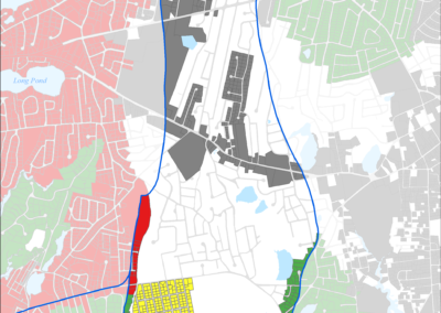
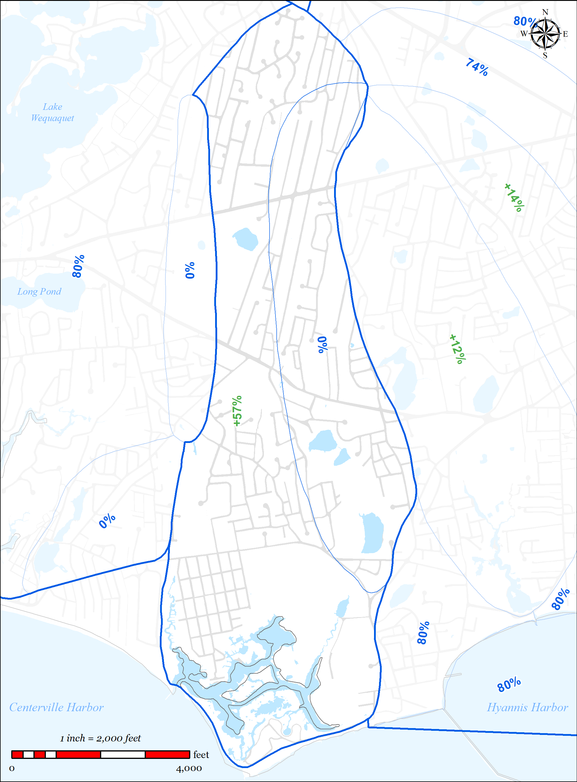
Figure 5-25: Sewer Expansion Plan in Halls Creek Watershed
-
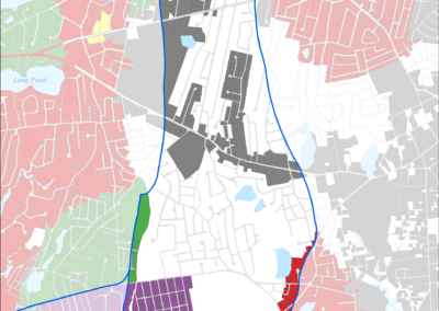
Figure 5-24: Needs Areas in Halls Creek Watershed
-
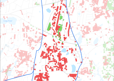
Figure 5-23: Parcels with Less than 0.25 acres in Halls Creek Watershed
-
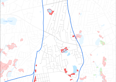
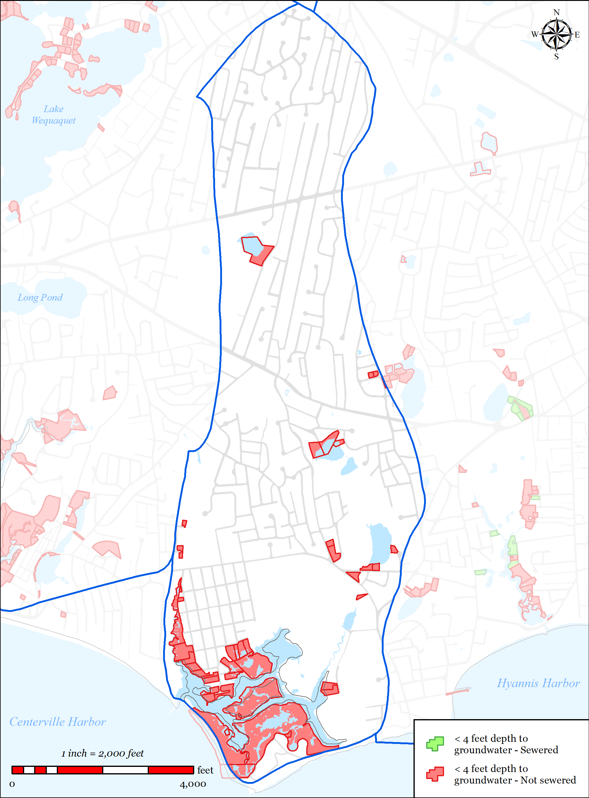
Figure 5-22: Parcels with Less than 4 feet Depth to Groundwater in Halls Creek Watershed
-
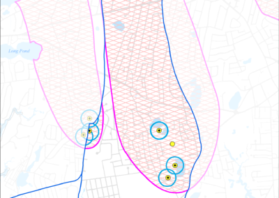
Figure 5-21: Public Water Supply Wells in Halls Creek Watershed
-
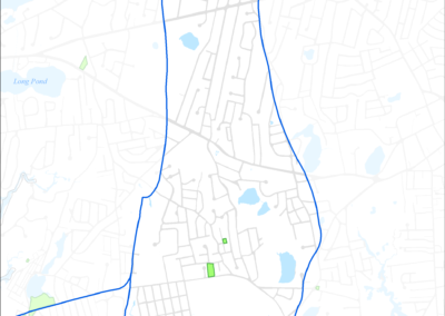
Figure 5-20: Parcels with I/A Septic Systems in Halls Creek Watershed
-
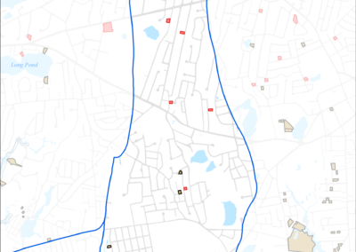
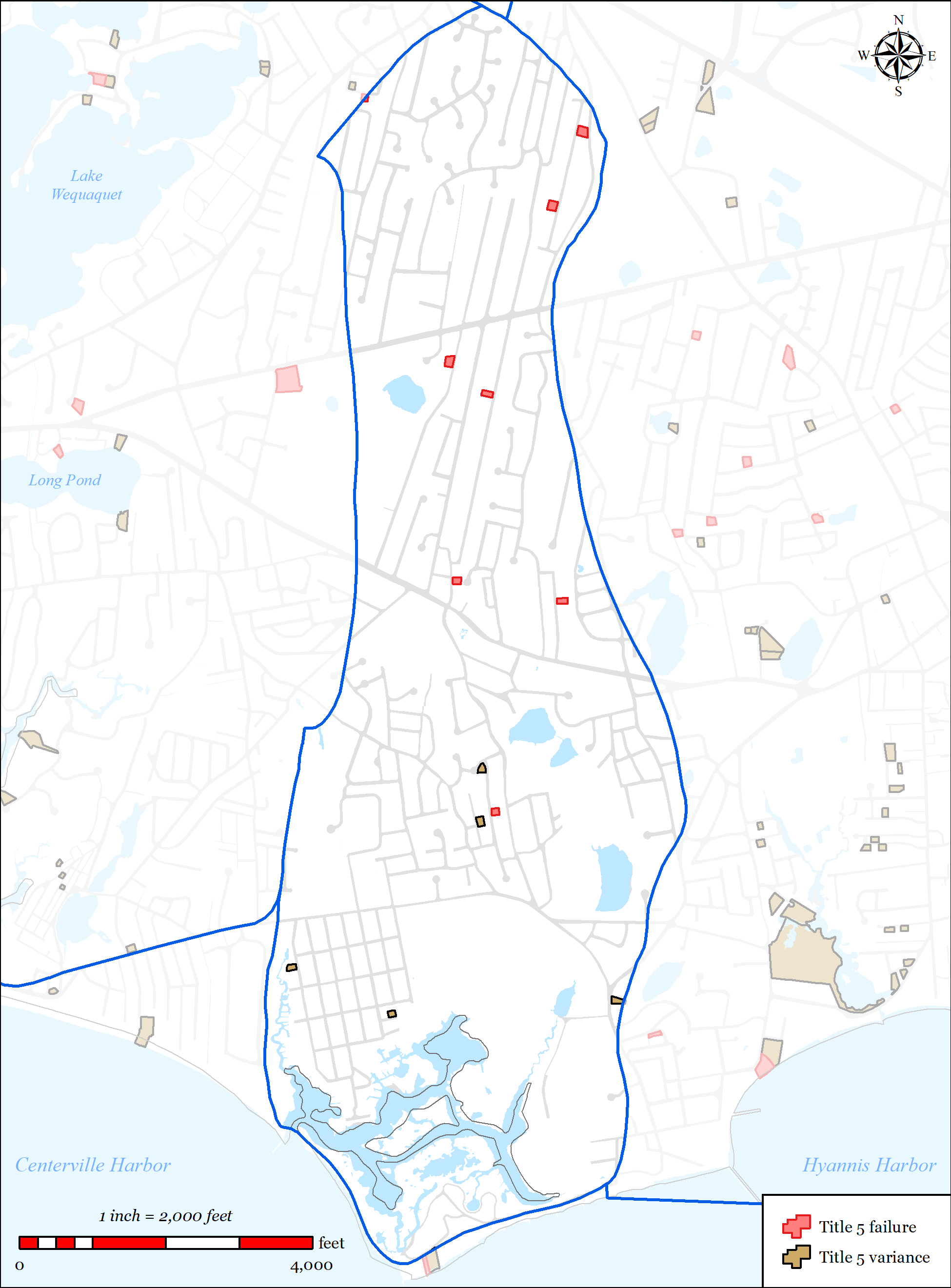
Figure 5-19: Parcels with Title 5 Septic Failures and Variances in Halls Creek Watershed
-
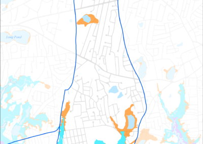
Figure 5-18: FEMA Flood Zones (2014) in Halls Creek Watershed
-
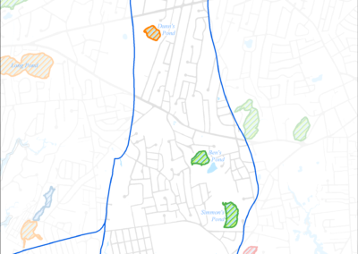
Figure 5-17: Impaired Ponds in Halls Creek Watershed
-
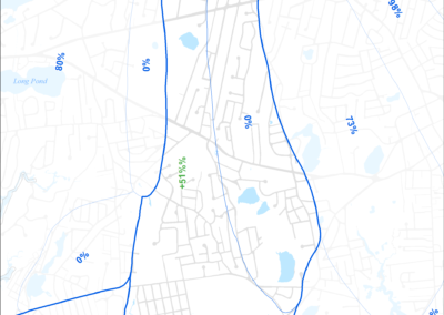
Figure 5-16: MEP-modeled Future Septic Removal in Halls Creek Watershed
-
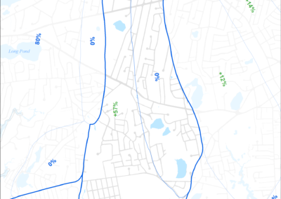
Figure 5-15: MEP-modeled Existing Septic Removal in Halls Creek Watershed
-
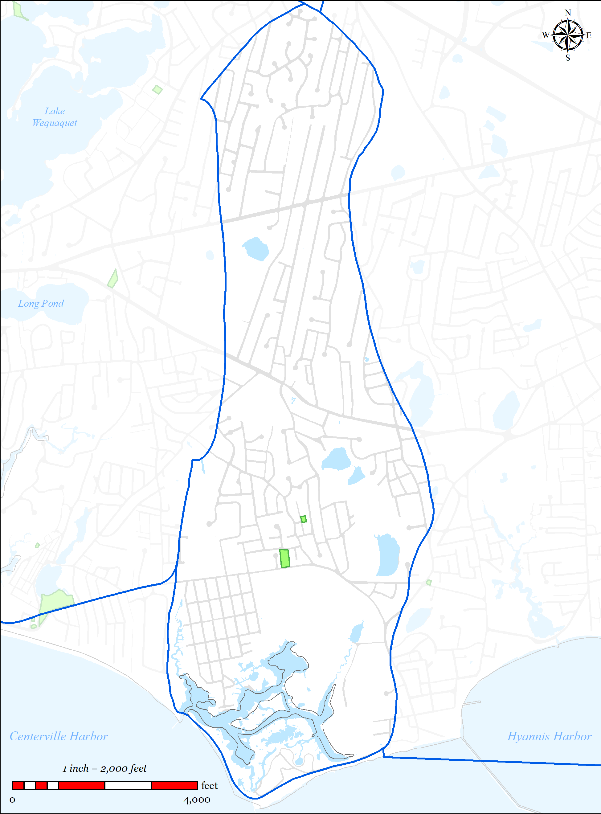
Figure 5-14: Halls Creek Watershed
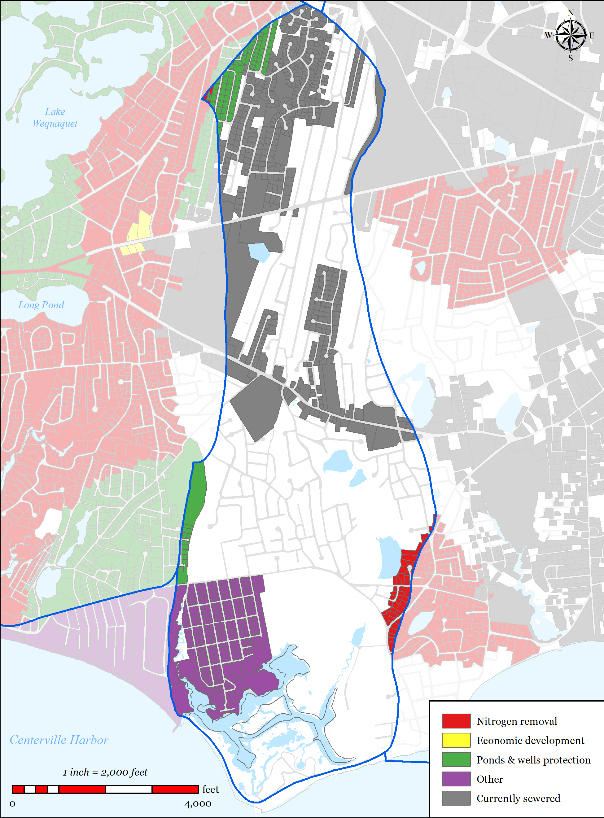


5.2.2.1.1 Nutrient Removal
The 2008 MEP Model has shown that the Halls Creek system has an assimilative capacity to accept additional nitrogen, therefore it has not considered a needs area for nitrogen removal. As a result, significant municipal sewer extensions in the watershed are not proposed to address nitrogen. A large section of the upper reaches of the watershed is already served by municipal sewer.
5.2.2.1.2 Wastewater Needs (Other Needs)
Title 5 Issues
The plan has been designed to address traditional Title 5 concerns via traditional sewer expansion within the aforementioned residential neighborhood in the southwestern corner of the watershed. Utilizing the Town’s wastewater planning GIS tool allowed Town staff to spatially map traditional Title 5 concerns such as small lot size, depth to groundwater, existing septic variances, existing known failed septic systems, and systems within Zone IIs. Parcels with area less than 0.25 acres were flagged because they were considered difficult to site a traditional septic system, likely to need septic variances, and increased density leading to increased nutrient loading. Parcels with an average depth of groundwater of less than four feet were flagged as likely to require raised systems which are costly and less desirable for community aesthetics. Existing septic variances and existing known failed septic systems were also mapped.
The tool allows the Town to overlay these layers to identify the “hot-spots” for traditional Title 5 concerns. These areas were then incorporated into the plan where practical. Many of these “hot- spots” overlaid other needs such as nutrients and pond protection. The Plan for the Halls Creek Watershed addresses traditional Title 5 concerns as shown in the data presented below (this data does not account for attenuated nitrogen data):
- Total parcels within the Halls Creek Watershed = 1,368
- Total parcels connected to existing municipal sewer = 329 (24%)
- Parcels with total area less than 0.25 acres = 642 (47%)
o 164 (25%) already served by municipal sewer
o 192 (30%) additional to be addressed with a traditional solution in the Plan o Total = 356 (55%)
Parcels with average depth to groundwater less than four feet = 33 (2%)
o 0 (0%) already served by municipal sewer
o 23 (70%) additional to be addressed with a traditional solution in the Plan o Total = 23 (70%)
Parcels with septic system variances = 5 (0.4%)
o 3 (60%) will be addressed with a traditional solution in the Plan
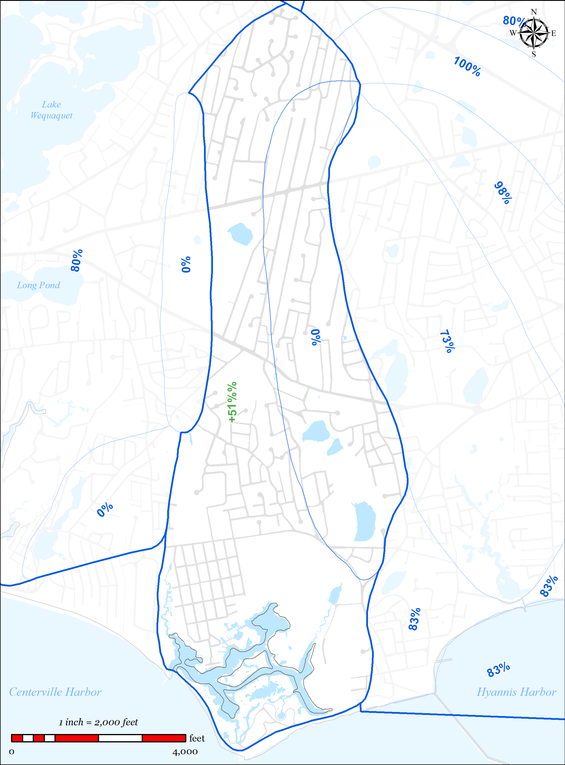
Parcels located within a Zone II = 856 (63%)
329 (38%) already served by municipal sewer
71 (8%) additional to be addressed with a traditional solution in the Plan Total = 400 (47%)
5.2.2.1.3 Pond Protection
The Town’s wastewater planning has included detailed studies of ponds 3 acres or larger throughout the Town. Through those studies, there is extensive water data for 3 ponds in the Halls Creek Watershed. Pond classification of these ponds is shown in Table 5-6 and Table 5-7.
Table 5-6: Halls Creek Watershed Pond Classification 2009
|
Ultra-Shallow 0 to 2.1m |
Shallow 2.1 to 8.6m |
Deep >8.6 |
|
|
Oligotrophic |
|||
|
Mesotrophic |
|||
|
Eutrophic |
Dunn’s Pond |
||
|
Hypereutrophic |
Table 5-7: Halls Creek Watershed Pond Classification 2017
|
Ultra-Shallow 0 to 2.1m |
Shallow 2.1 to 8.6m |
Deep >8.6 |
|
|
Oligotrophic |
|||
|
Mesotrophic |
Ben’s Pond |
||
|
Eutrophic |
Simmons Pond |
||
|
Hypereutrophic |
Two ponds within the watershed have been identified as impaired; Dunn’s Pond and Simmons Pond.
Flood Zones
Low lying areas within the aforementioned residential neighborhood in the southwestern corner of the watershed adjacent to the Halls Creek estuary system have been identified as needs areas for sewer expansion due to being within the 100 year floodplain and/or the velocity zone, and generally having shallow depth to groundwater. As a result of these conditions, traditional Title 5 septic systems are difficult and costly to site in these areas.
Total parcels within the Halls Creek Watershed = 1,368
Parcels within FEMA mapped 100-year flood zone (AE/AO) or velocity zone (VE) = 130
o 0 (0%) already served by municipal sewer
o 92 (71%) that will be addressed with a traditional solution in the Plan o Total = 92 (71%)
PROPOSED SOLUTIONS
The plan addresses the needs areas using the following techniques:
Sewer Expansion
o 329 of the 1,368 parcels (24%) located in the watershed are served by municipal sewer
o 351 of the 1,368 parcels (26%) located in the watershed in the Town are included in the sewer expansion plan
Stormwater upgrades
o The Town’s MS4 program will identify and provide solutions to existing stormwater outfalls.
15 of the Town’s 207 identified stormwater outfalls are located in the Halls Creek Watershed.
o The Town’s Public Road program invests on average $750,000 a year in stormwater improvements in the Town’s public roads. These improvements generally include replacement of failed catch basins and leaching structures.
Fertilizer Regulation
o In 2014 the Town adopted a Fertilizer Nitrogen and Phosphorus Control Regulation (see Appendix PP). The regulation includes the following:
Provides Best Management Practices and performance standards for noncertified fertilizer applicators.
Outlines education, certification, enforcement and penalties.
5.2.2.3 FUTURE CONDITIONS
The plan accommodates future growth conditions as follows:
- The watershed has significant assimilative capacity to accept additional nitrogen.
- The majority of the watershed is significantly built-out and there are not significant development potential areas identified in the watershed.
- Adaptive management and monitoring
o The Town will continue to monitor the embayment, review the Plan and provide formal updates as required.
o Refer to Section 6.4 for the Adaptive Management Plan and Section 6.3 for the Monitoring Plan.