
Comprehensive Wastewater Plan (CWMP)
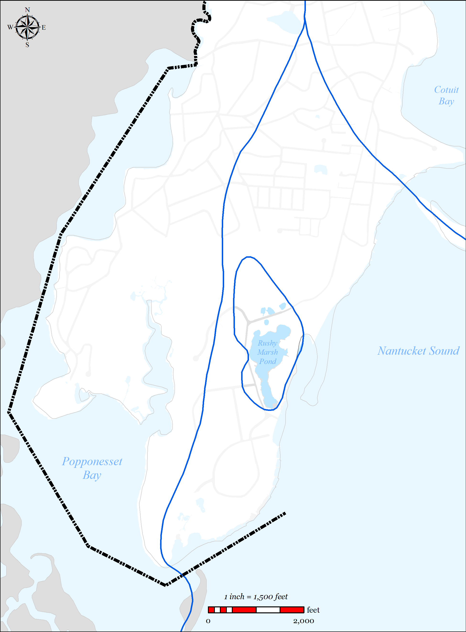
The Rushy Marsh Embayment System is a small estuary located within the village of Cotuit. It is bounded by Main Street Cotuit on one side and Nantucket Sound on the other, and is located between the Popponesset Bay and Three Bays watersheds. According to the MEP report, virtually all the watershed’s freshwater and nutrients enter Rushy Marsh via groundwater seepage, as there are no significant surface inflows to this system. Refer to Figure 5-53 for a figure showing the Rushy Marsh Embayment system. For a detailed description of the embayment system, refer to the 2006 MEP Report for the Rushy Marsh Embayment System (Appendix V).
The open water area of the marsh is approximately 15 acres, thus making it a great salt pond. USGS maps from 1893 show Rushy Marsh as a fully tidal estuary with salt marsh along its eastern and northern shores. During the 1900’s the tidal inlet became restricted due to sedimentation deposits and the formation of a barrier beach. There were attempts to keep the system tidal with pipes and culverts, but ultimately the process of barrier beach formation resulted in a freshening of Rushy Marsh Pond. By the turn of the century, the system was a brackish salt pond.
The pond currently does not support eelgrass, and mapping from 1951 indicates it was not present then either. Given this lack of documentation of an eelgrass population, it is not clear that even when the system was much better flushed, it supported eelgrass beds. However, to the extent that conditions could be improved to the level required for eelgrass colonization, the acreage would likely range from 4-12 acres, most likely in the southern channel and the margins of the main basin.
5.2.5.1 SUMMARY OF NEEDS 5.2.5.1.1 Nutrient Removal
The 2006 MEP report states “While Rushy Marsh Pond presently has a relatively low nitrogen load from its watershed, due to its small size and proportionally large undeveloped areas, it is still significantly impaired by nitrogen enrichment and is clearly eutrophic. This apparent paradox results from its very low tidal exchange rate, resulting from barrier beach processes restricting the inlet to Nantucket Sound.”
-

Figure 5-53: Rushy Marsh Watershed
-

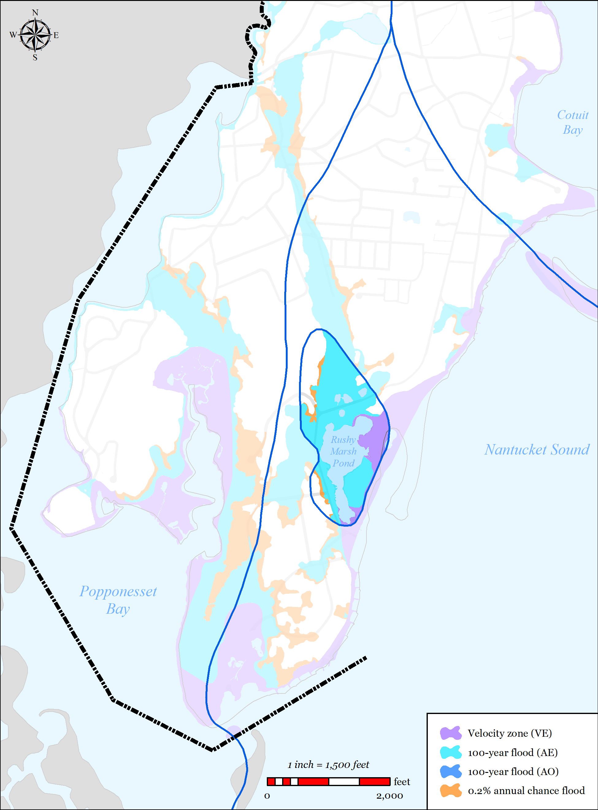
Figure 5-54: FEMA Flood Zones (2014) in Rushy Marsh Pond Watershed
-

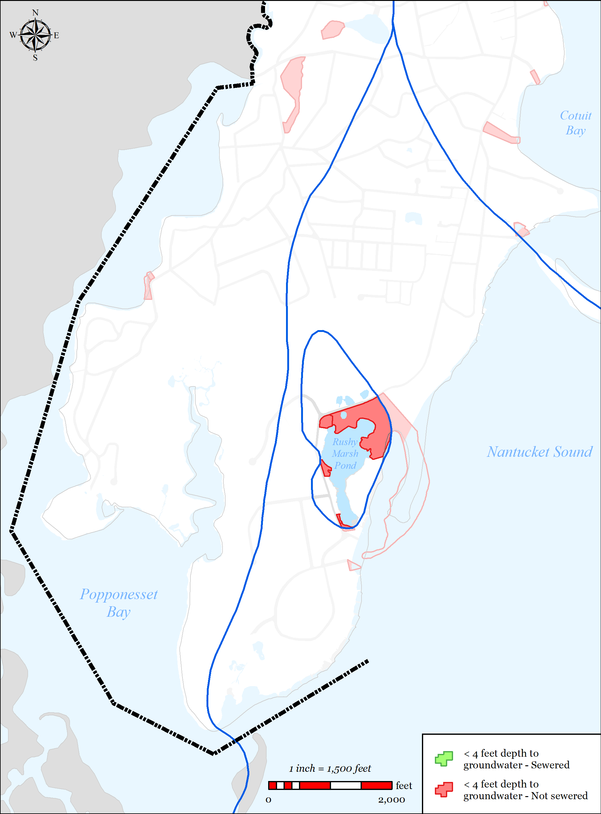
Figure 5-55: Parcels with Less than 4 feet Depth to Groundwater in Rushy Marsh Watershed
5.2.5.1.2 PROPOSED SOLUTIONS
The 2006 MEP report suggested that even if the Town removed 100% of the septic load that feeds into this pond, the pond would still be impaired due to its isolation from the sound. They went on to hypothesize that “…in order to meet the threshold concentrations in the system, alternative approaches beyond load reductions are required to increase circulation and water exchange with Nantucket Sound.”
MEP went on to run some simple models on the system assuming the inlet was increased to 4 feet and again to 10 feet. What they found was the total nitrogen concentrations were significantly reduced with the modeled inlets, and that the reduction would be large to meet the threshold limits that they suggested for the marsh.
In response to these findings the Town, working with Applied Coastal Research and Engineering (ACRE), designed and installed a new inlet consisting of a 10-foot wide box culvert in the southern portion of the basin in 2012. However, within several months the new inlet had completely shoaled and filled with sand to the point that the new inlet was undistinguishable from the existing beach (see Figure 5-51, and Figure 5-52), which eliminated tidal flow and flushing.
In 2014, the Town had the Woods Hole Group conduct a forensic analysis of the project. What they found was that the tidal prism of Rushy Marsh was inadequate to maintain a stable inlet given the rate of littoral sand transport along the beach. In fact, they concluded that a stable inlet is not feasible for the as-built inlet without substantial maintenance and the addition of hard structures (jetties), or an extended large pipe well into the surf zone. Their initial calculations indicated that the jetty lengths would have to be between 122 ft and 145 ft long.
Given this finding, and the Town’s understanding of the difficulty of permitting new hard structures such as these in the surf zone, it elected to forgo any further action on this watershed.

Figure 5-51: Rushy Marsh New Inlet, Newly Installed, Perspective Looking Toward Nantucket Sound
Figure 5-52: Rushy Marsh New Inlet, After Shoaling, Perspective from Nantucket Sound
