Comprehensive Wastewater Plan (CWMP)
The Three Bays Embayment System is located in the southwestern portion of the Town of Barnstable. The embayment is a complex estuary with multiple inlets and sub-embayments (Cotuit Bay, West Bay, North Bay, Prince Cove, Warren’s Cove). The estuary receives tidal waters from Nantucket Sound into its two large lower basins: Cotuit Bay to the west of Osterville Grand Island and West Bay to the east of Grand Island. For a detailed description of the embayment system, refer to the 2006 MEP Report for the Three Bays Embayment (Appendix W).
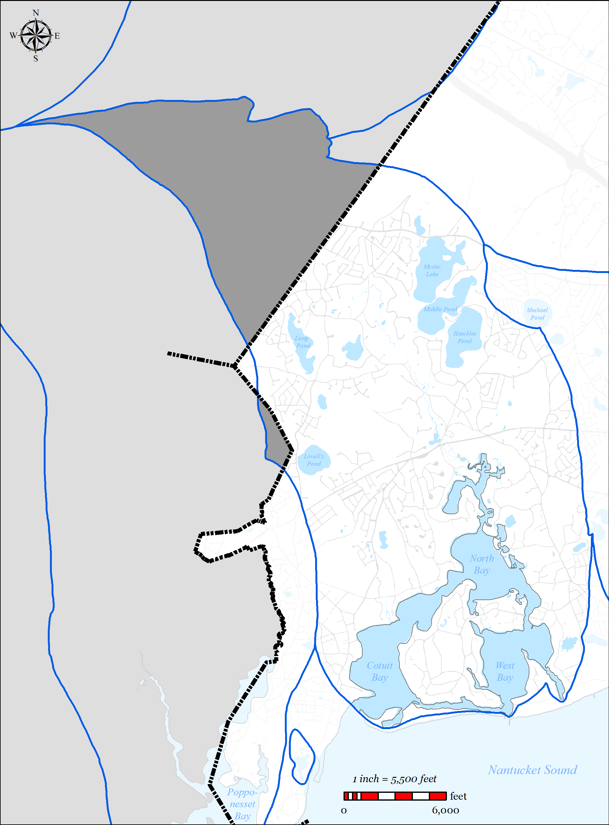
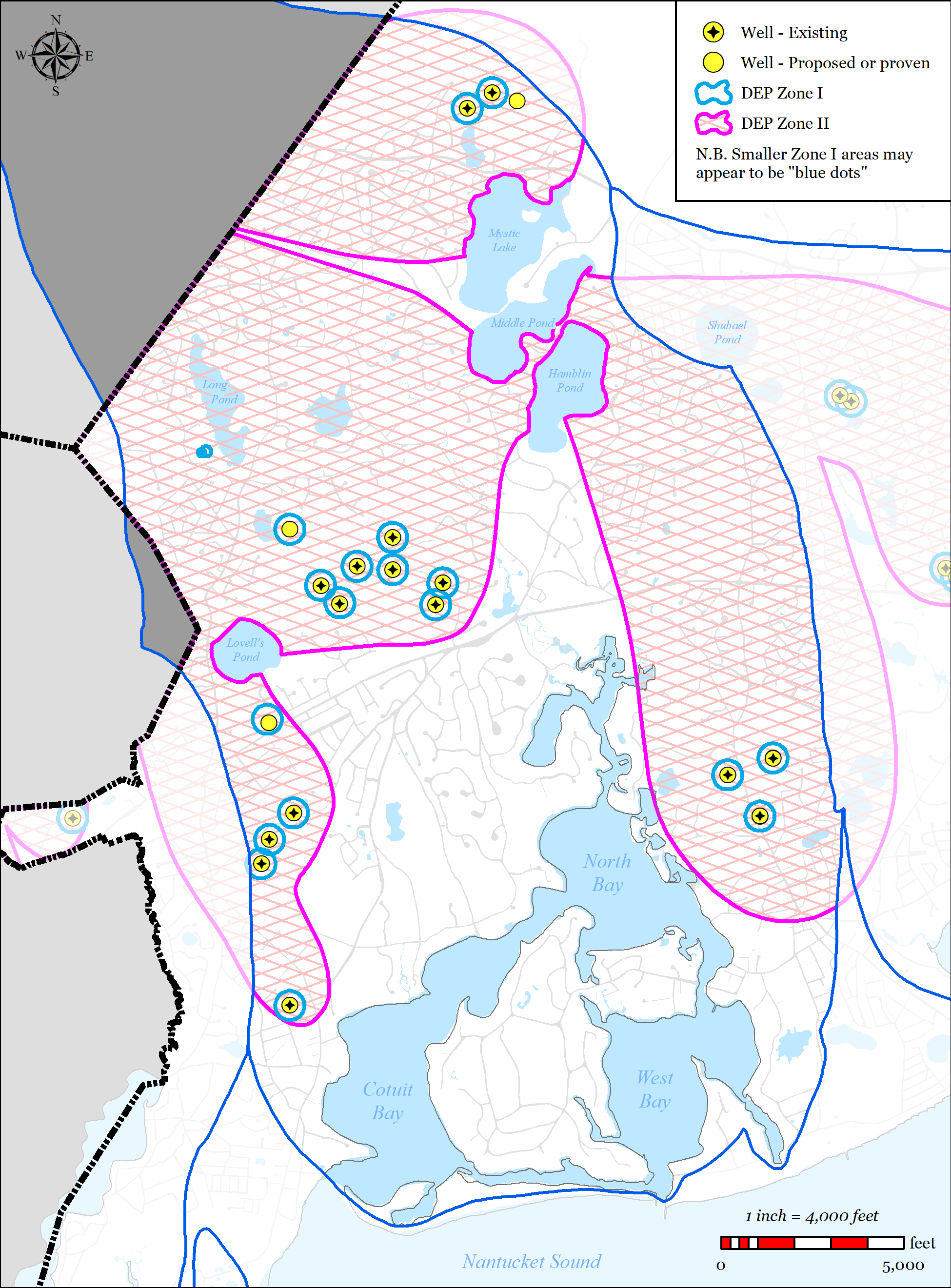
The Three Bays Watershed is approximately 6,739 acres and is located almost entirely within the Town of Barnstable (see Figure 5-38). Within the watershed there are 39 identified surface waters including 14 named freshwater ponds and 4 significant freshwater stream outlets (Skunknett River, Bumps River, Long Pond Stream, Lake Elizabeth). Within the watershed, COMM Water District operates 9 drinking water wells and Cotuit Water District operates 4 drinking water wells. The Town does not operate any wastewater treatments facilities within the Three Bays Watershed.
The Town of Barnstable’s wastewater plan has been designed to address multiple needs areas within the Three Bays Watershed, including nutrient removal, pond protection, traditional wastewater concerns and economic development, via sewer expansion into Three Bays Watershed. The Plan also includes non-traditional solutions, which will be installed in the first phase of the plan. The Town will not ask for credit up front, but will be monitoring the results of those solutions over 5-10 years, thus establishing their benefit. With that benefit firmly established, the Town would then ask DEP for relief from that amount of traditional nitrogen removal (sewers) contained in the later phases of the plan.
5.2.4.1 SUMMARY OF NEEDS
The Town of Barnstable’s wastewater plan has been designed to address multiple needs areas within the Three Bays Watershed, including nutrient removal, pond protection, water supply protection, flood zone considerations and economic development, via sewer expansion within the Three Bays Watershed.
-
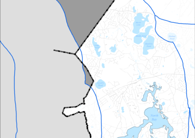
Figure 5-38: Three Bays Watershed
-
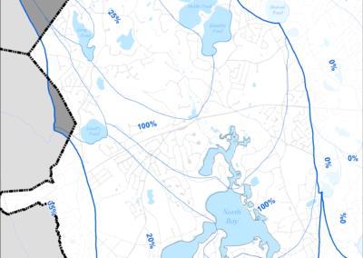
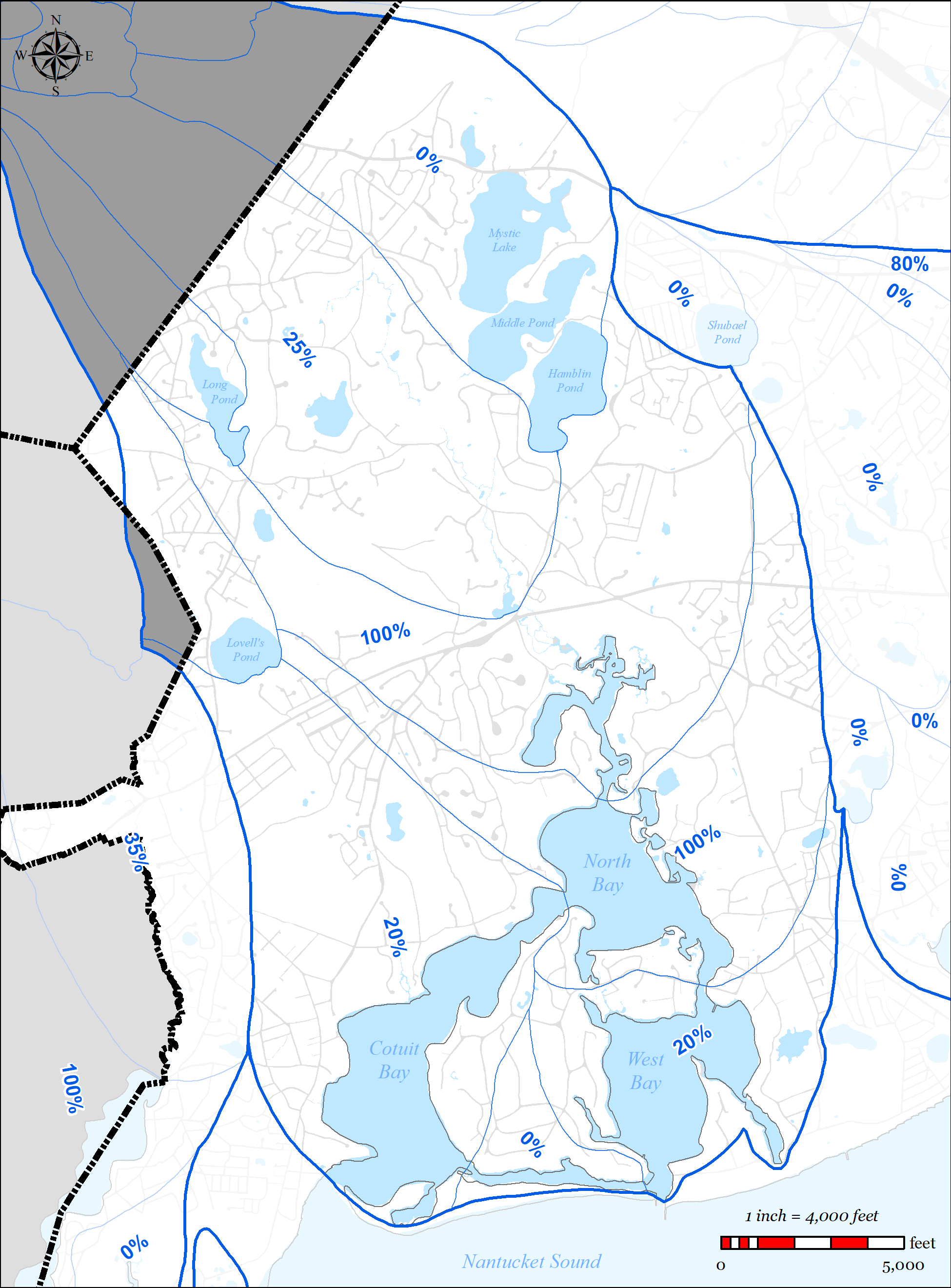
Figure 5-39: MEP-modeled Existing Septic Removal in Three Bays Watershed
-

Figure 5-40: MEP-modeled Future Septic Removal in Three Bays Watershed
-
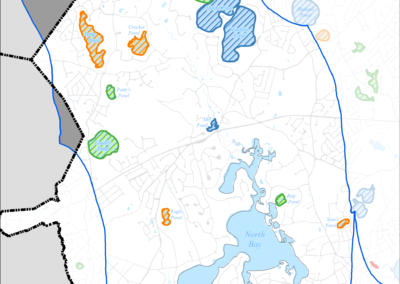
Figure 5-41: Impaired Ponds in Three Bays Watershed
-
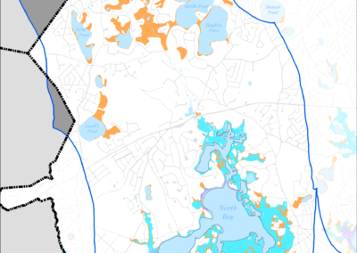
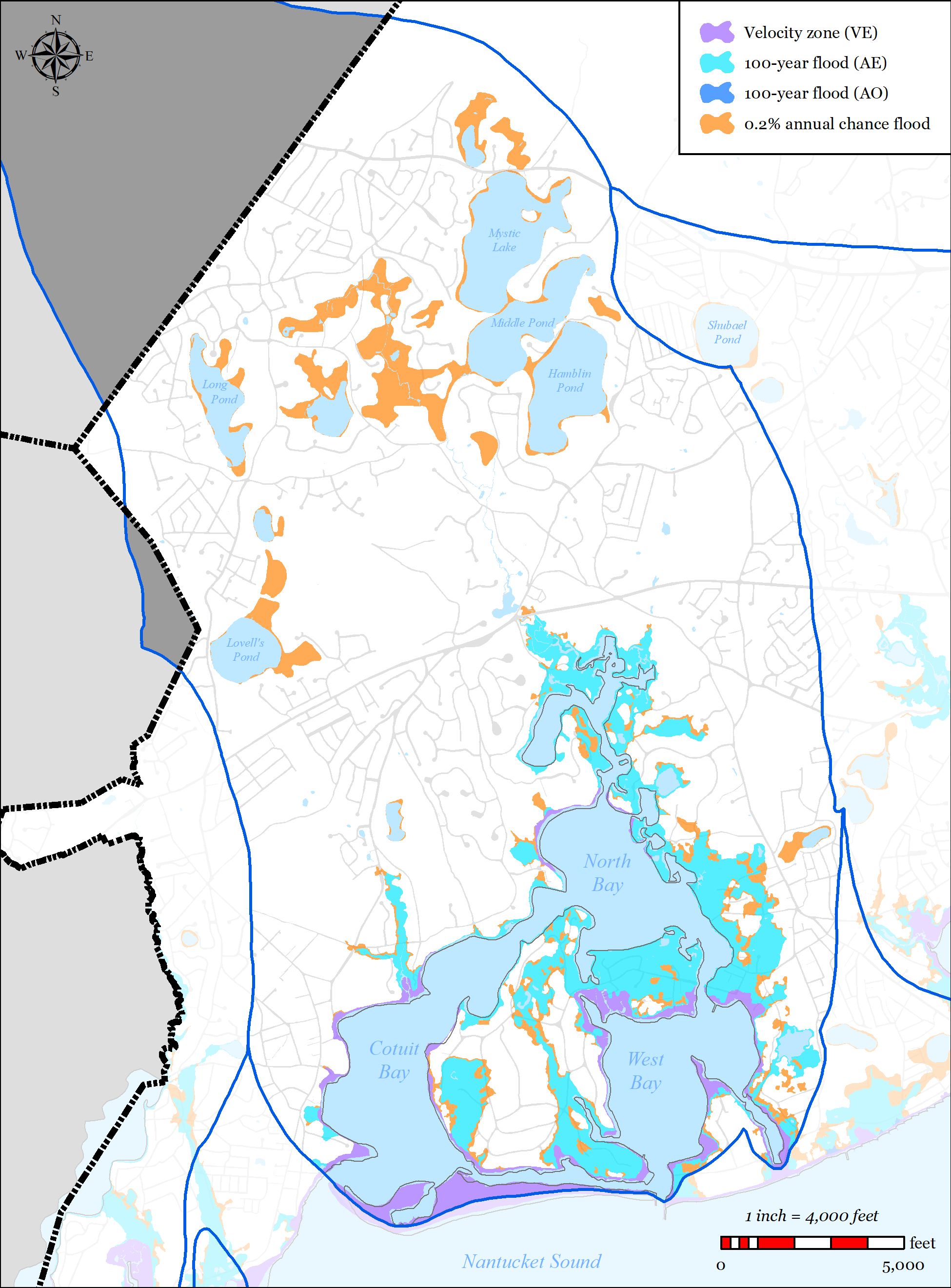
Figure 5-42: FEMA Flood Zones (2014) in Three Bays Watershed
-
Figure 5-43: Parcels with Title 5 Septic Failures and Variances in Three Bays Watershed
-
Figure 5-44: Parcels with I/A Septic Systems in Three Bays Watershed
-
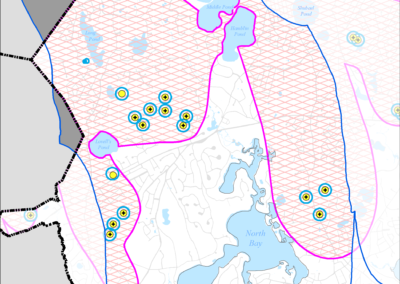
Figure 5-45: Public Water Supply Wells in Three Bays Watershed
-
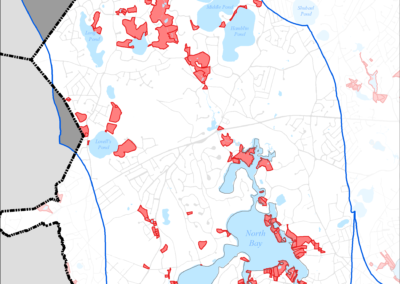
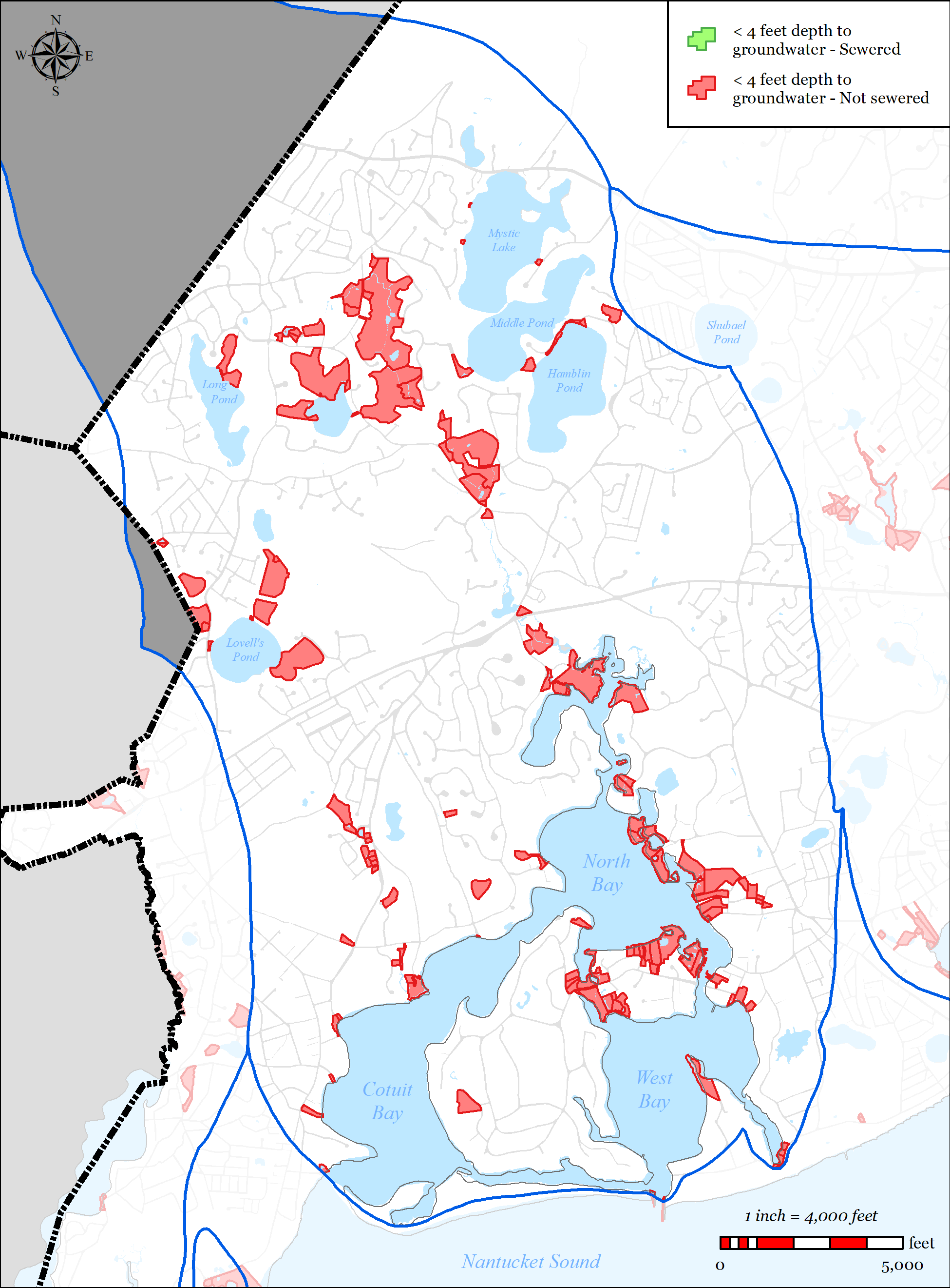
Figure 5-46: Parcels with Less than 4 feet Depth to Groundwater in Three Bays Watershed
-
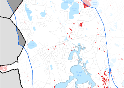
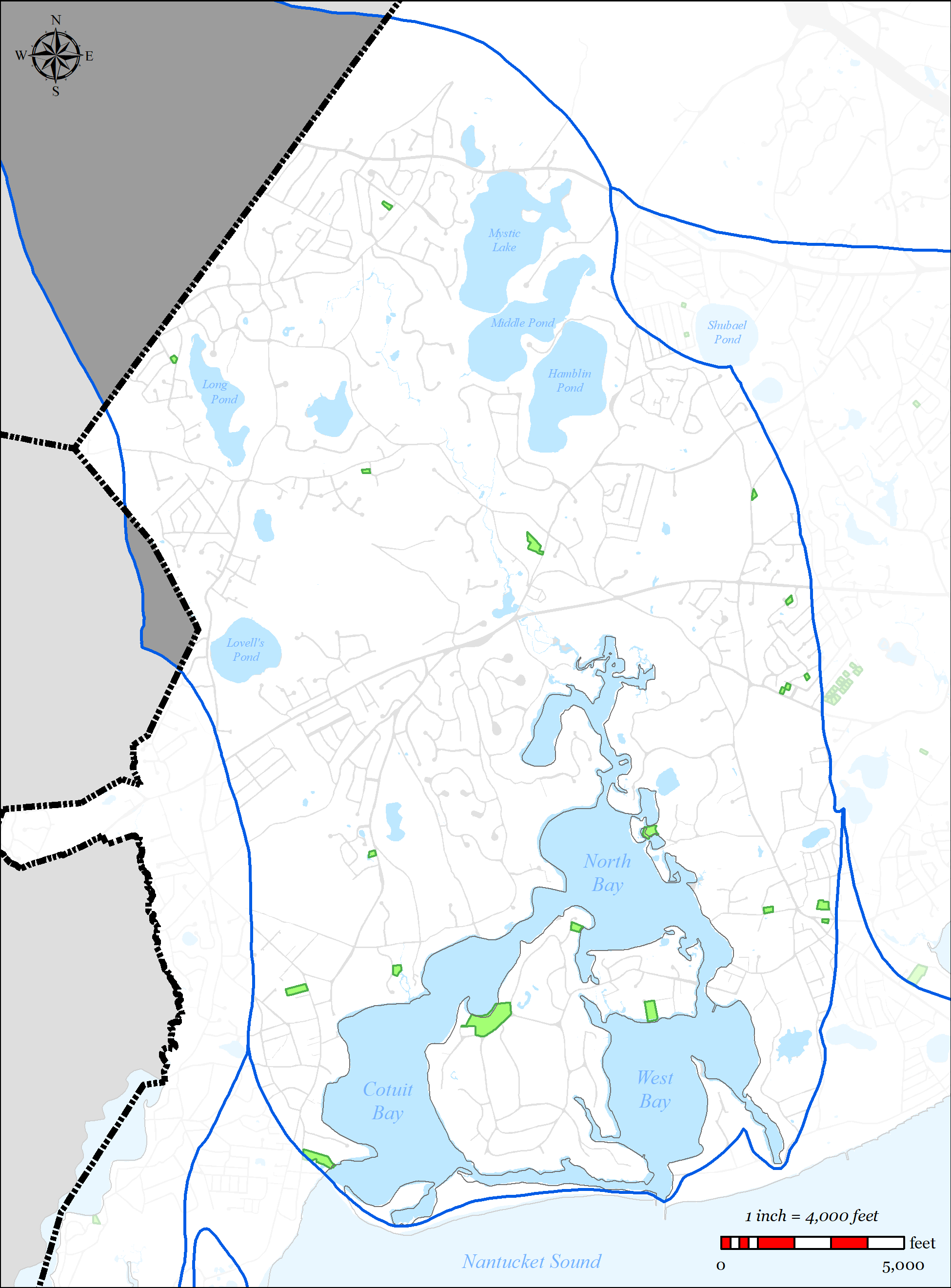
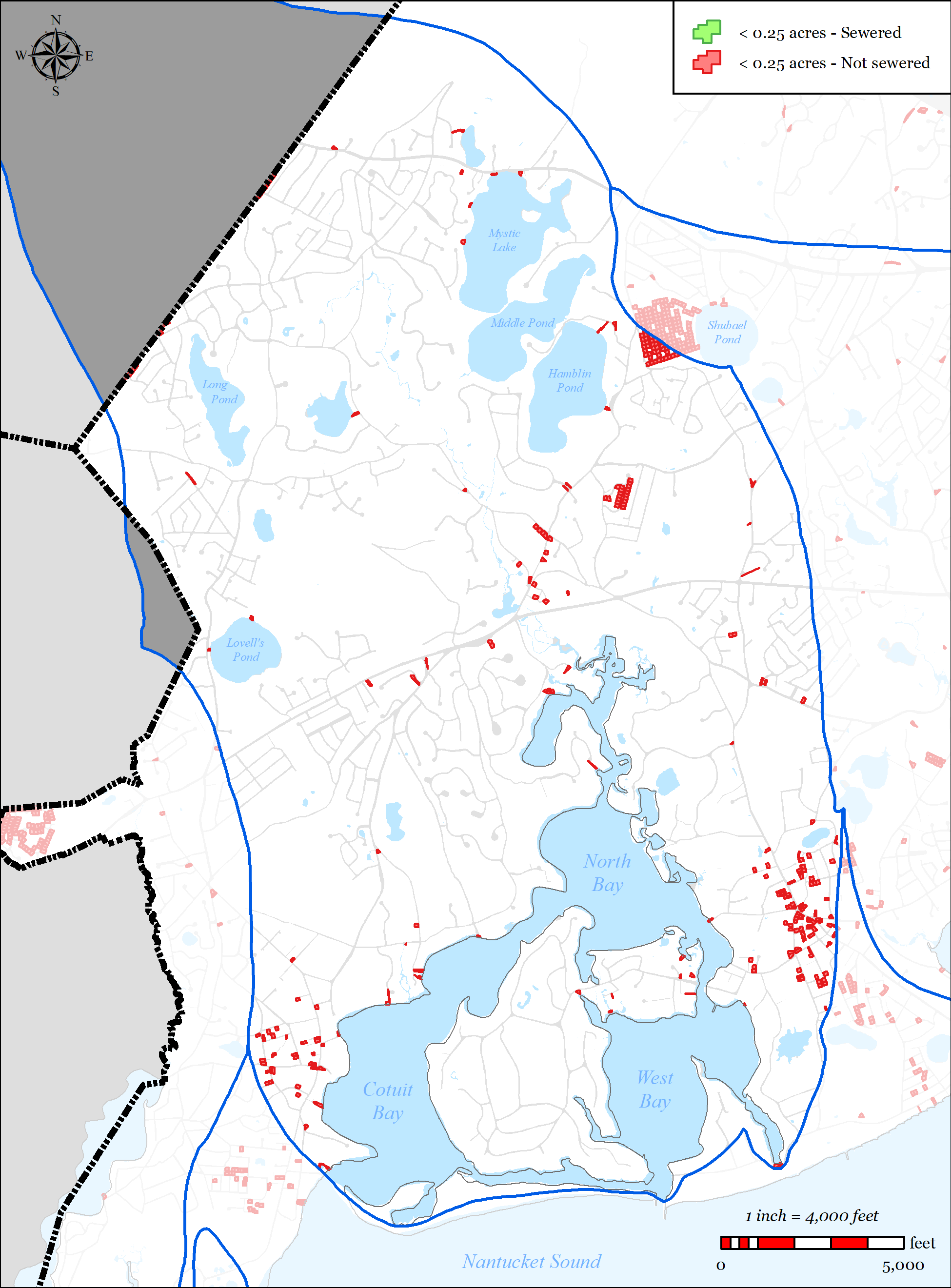
Figure 5-47: Parcels with Less than 0.25 acres in Three Bays Watershed
-
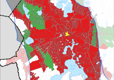
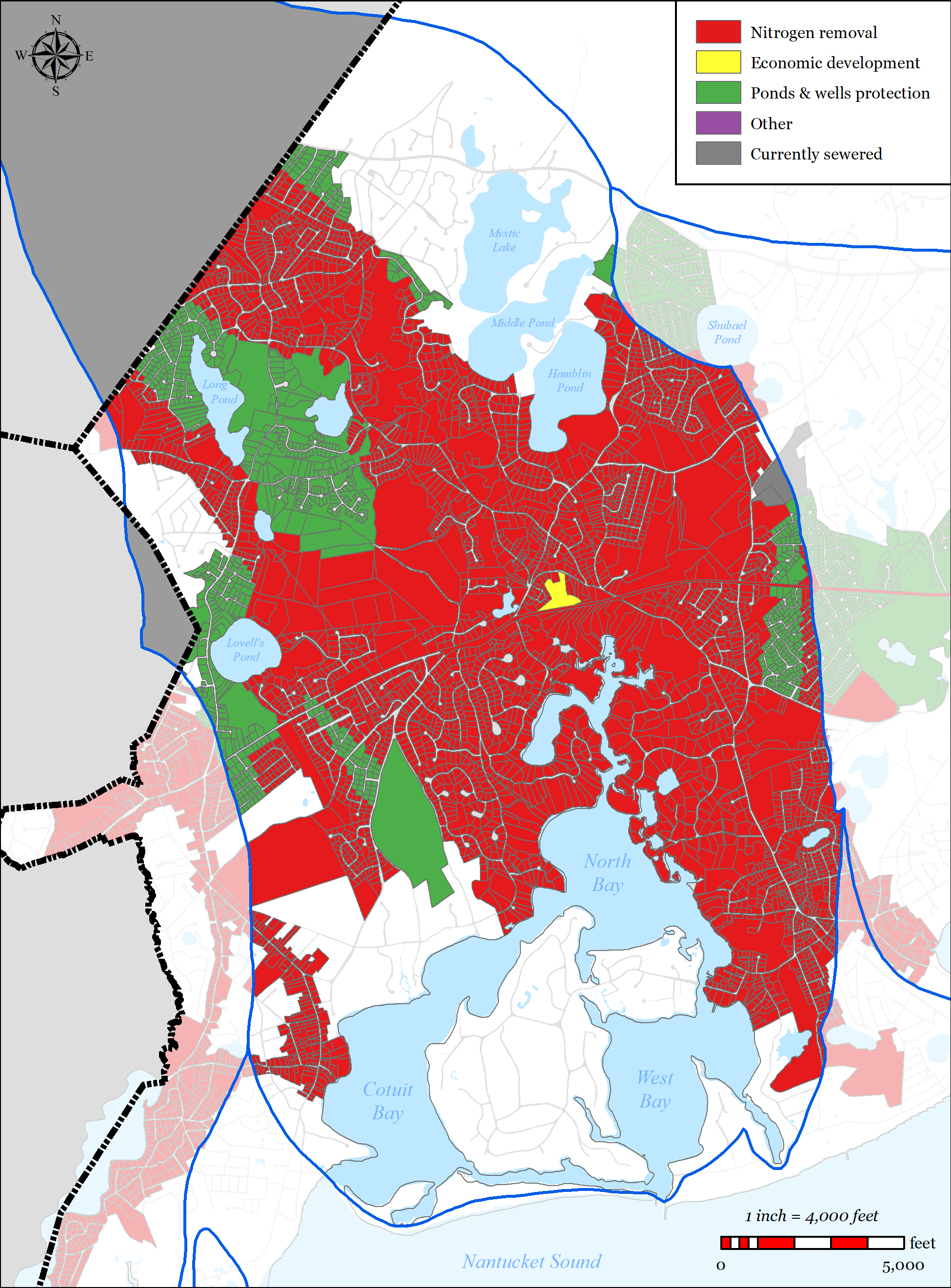
Figure 5-48: Needs Areas in Three Bays Watershed
-
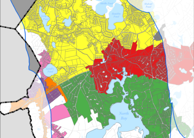
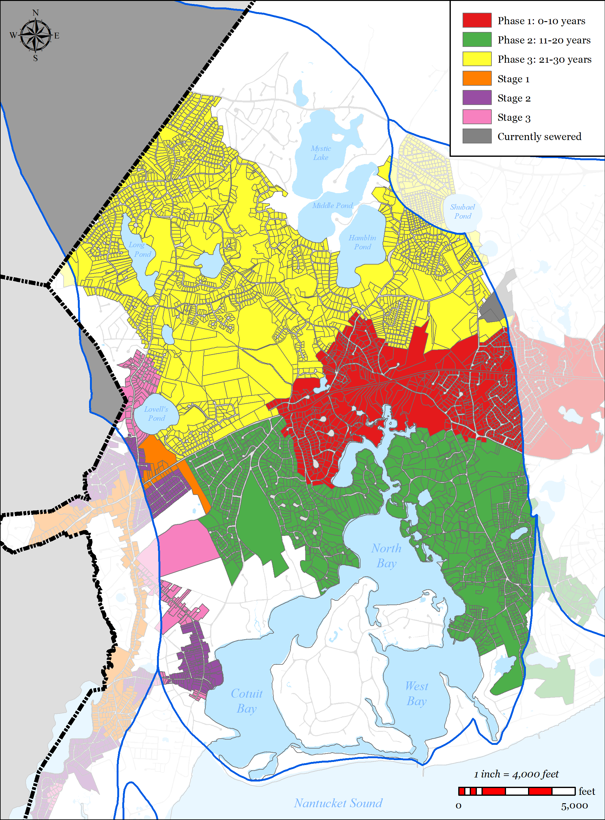
Figure 5-49: Sewer Expansion Plan in Three Bays Watershed
-
Figure 5-50: Non-Traditional Projects


5.2.4.1.1 Nutrient Removal
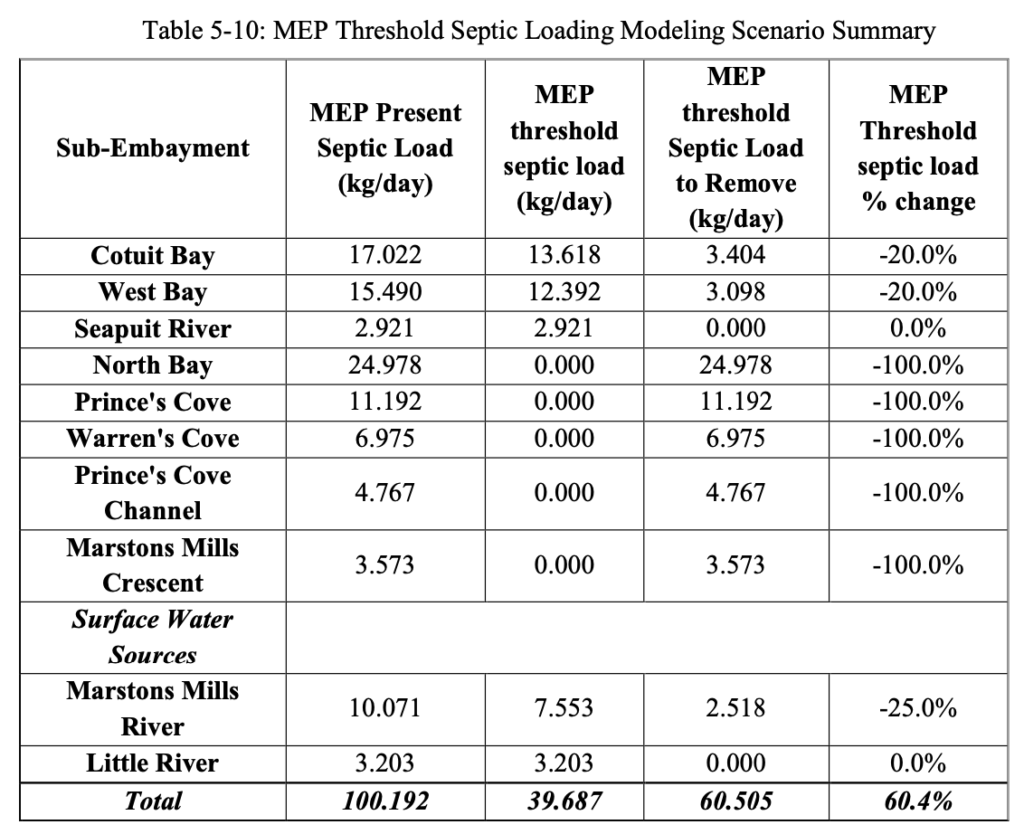
The Town’s wastewater plan has been designed to exceed the septic load removals modeled in the 2006 MEP Report’s threshold loading scenarios in order to meet the regulatory TMDLs. A summary of the modeled threshold septic loading scenario is provided in Table 5-10 and is shown graphically in Figure 5-39. The Town’s sewer expansion plan has been designed to achieve the threshold septic load removal percentages in each sub-embayment.
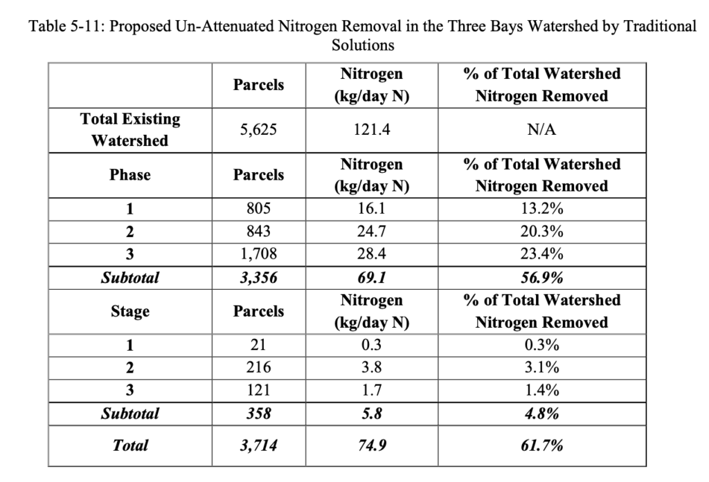
Nitrogen data reported below in Table 5-11, is from the Town of Barnstable’s wastewater planning GIS tool and reflects calculated existing, un-attenuated nitrogen septic loads based upon existing water use data.
5.2.4.1.2
Traditional Wastewater Needs (Other Needs)
Title 5 Issues
Integral to the planning process was the Town’s development of a wastewater planning GIS tool which allowed Town staff to spatially map traditional Title 5 concerns such as small lot size, depth to groundwater, existing septic variances, existing known failed septic systems, and Zone IIs. Parcels with area less than 0.25 acres were flagged because of they were considered difficult to site a traditional septic system, likely to need septic variances, and increased density leading to increased nutrient loading. Parcels with an average depth of groundwater of less than four feet were flagged as likely to require raised systems which are costly and less desirable for community aesthetics. Existing septic variances and existing known failed septic systems were also mapped.
The tool allows the Town to overlay these layers to identify the “hot-spots” for traditional sewering solutions. These areas were then incorporated into the plan where practical. Many of these “hot-spots” overlaid other needs such as nutrients and pond protection. The Plan for the Three Bays Watershed significantly addresses traditional Title 5 concerns as shown in the data presented below which was calculated using the Town’s wastewater planning GIS tool (this data does not account for attenuated nitrogen data):
- Total parcels within the Three Bays Watershed = 5,625
- Parcels with total area less than 0.25 acres = 336
o 208 (62%) will be addressed with a traditional solution in the Plan Parcels with average depth to groundwater less than four feet = 143
o 62 (43%) will be addressed with a traditional solution in the Plan Parcels with septic system variances = 36
o 12 (33%) will be addressed with a traditional solution in the Plan Parcels with known failed septic systems = 2
o 2 (100%) will be addressed with a traditional solution in the Plan Parcels located within a Zone II = 3,479
o 2,671 (77%) will be addressed with a traditional solution in the Plan
Flood Zones
Low lying areas adjacent to the Three Bays system have been identified as needs areas for sewer expansion due to being within the 100 year floodplain and/or the velocity zone, and generally having shallow depth to groundwater. As a result of these conditions, traditional Title 5 septic systems are difficult and costly to site in these areas.
- Total parcels within the Three Bays Watershed = 5,625
- Parcels within 100 year flood plain and/or velocity zone = 718 (13%)
o 481 (67%) will be addressed with a traditional solution in the Plan (including those portions of the plan that are located within the 3 “stages”).
Contaminants of Emerging Concern (CECs)
Contaminants of emerging concern (CECs) are increasingly being detected in surface water.
(CECs) are made up of three general groups, endocrine disrupting compounds, pharmaceuticals, and personal care products. These compounds and potential contaminants are not currently regulated by the federal government because their toxicity is not well understood. Collecting wastewater with sewers and treating at a centralized treatment location allows the opportunity to treat wastewater for CECs as they are better understood and future treatment technologies are developed.
5.2.4.1.3 Pond Protection
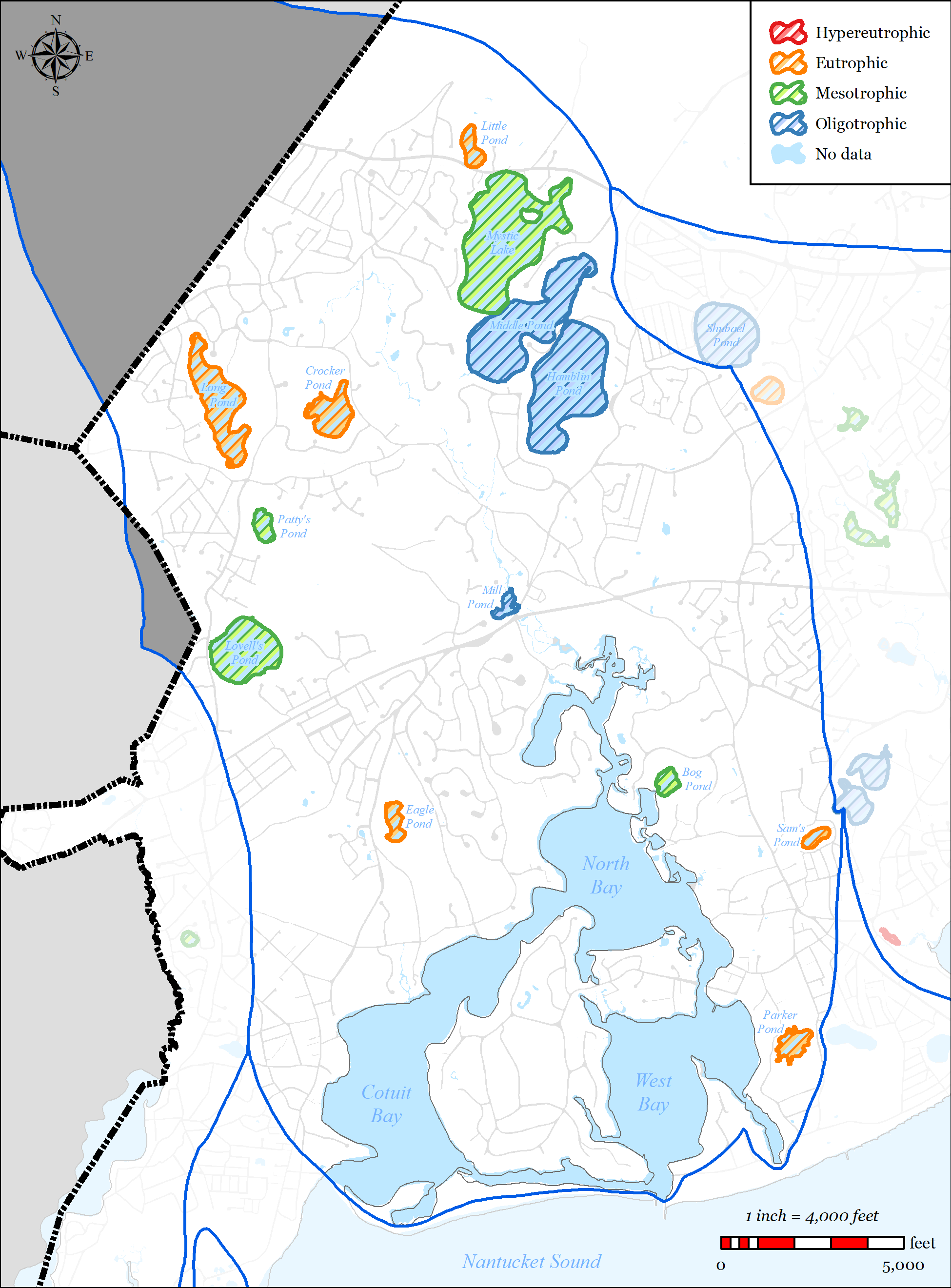
The Town’s wastewater planning has included detailed studies of ponds 3 acres or larger throughout the Town. Through those studies, there is extensive water data for 12 ponds in the Three Bays Watershed. Pond classification of these ponds is shown in Table 5-12 and Table 5-13.
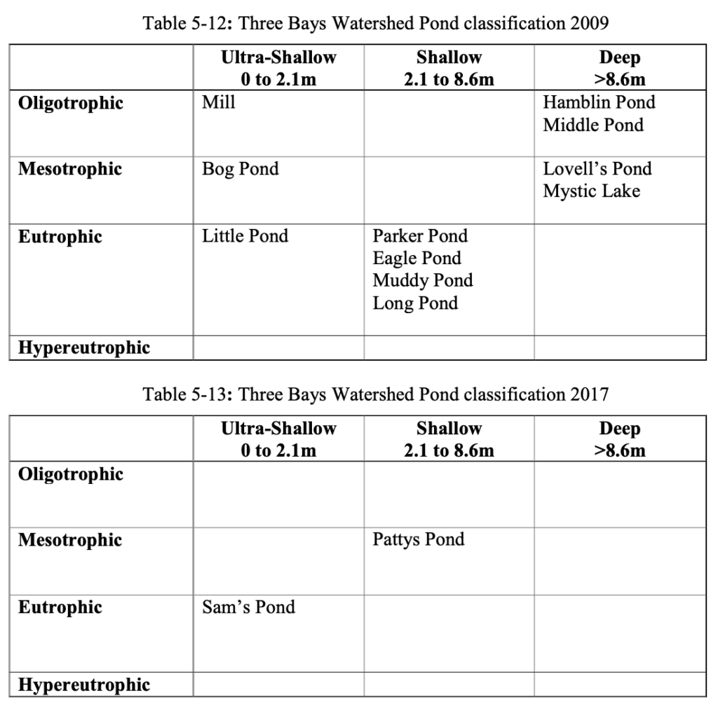
Seven ponds within the watershed have been identified as impaired: Pattys Pond, Parker Pond, Little Pond, Eagle Pond, Muddy Pond, Long Pond, and Sam’s Pond.
5.2.4.1.4 Economic Development
Sewer expansion is required within the Route 28 corridor to facilitate the sewer expansion needs of the western portion of the Town. Additionally, the Route 28 corridor has also been identified by the Town as an area desired for economic development. Development within this corridor has historically been restricted by wastewater requirements (i.e. Title 5) and the Town’s Salt Water Estuary’s Regulation. The Town’s wastewater plan has included sewer expansion of the entire Route 28 corridor to accommodate these goals.
5.2.4.2 PROPOSED SOLUTIONS
The Town’s plan for the Three Bays Watershed incorporates both traditional solutions (sewer expansion) and non-traditional solutions (dredging, stormwater, etc.). The plan has been designed to meet the target septic removal via traditional sewer expansion alone. The sewer expansion is phased over three, 10-year phases, addressing the densest areas in the first two phases and the less dense (more expensive) areas in the third phase. During the first two phases, the Town intends to install non-traditional solutions, monitor them, and present the monitoring results to regulators. If the non-traditional solutions are effective, the Town’s goal would be to reduce the amount of sewer expansion required in Phase 3. However, the Town is not seeking “credit” for these non-traditional projects at this time and has presented a plan that meets the Three Bays Watershed TMDL via traditional sewer expansion alone.
The plan addresses the needs areas using the following techniques:
Sewer Expansion
o 3,714 parcels (66%) in the watershed are included in the sewer expansion plan
o Removal of 61.7% (74.9 kg/day N) of the total existing un-attenuated septic load in the watershed.
Stormwater upgrades
o The Three Bay’s Stormwater Project will continue. Refer to Section 2.2.1.2 for projects completed to date.
o The Town’s MS4 program will identify and provide solutions to existing stormwater outfalls.
36 of the Town’s 207 identified stormwater outfalls are located in the
Three Bays Watershed.
o The Town’s Public Road program invests on average $750,000 a year in stormwater improvements in the Town’s public roads. These improvements generally include replacement of failed catch basins and leaching structures.
Mill Pond Dredging
Town of Barnstable 5-65 Comprehensive Wastewater Management Plan
o Continue to evaluate, design, and permit the project as discussed in Section 2.3.2.2.
Cranberry Bog Conversions
o Continue to support partners (BCWC and others) in pursuit of projects to convert the cranberry bogs in the upper end of the Marstons Mills River system to nutrient removal practices as discussed in Section 2.3.2.1.
Alternative Septic Systems
o Continue to support partners (BCWC and others) in evaluation of technologies and installation of pilot projects as discussed in Section 3.1.2.5.
Aquaculture
o Existing commercial aquaculture grants in the Three Bays = 62 acres.
o Continue to evaluate aquaculture opportunities in Warren’s Cove as discussed in
Section 2.3.2.4.
Dredging of Cotuit Bay Cut
o Three phase project anticipated to be completed in the winter of 2020. o Anticipated to improve flushing within Cotuit Bay.
Fertilizer Regulation
o In 2014 the Town adopted a Fertilizer Nitrogen and Phosphorus Control
Regulation (see Appendix PP). The regulation includes the following:
Provides Best Management Practices and performance standards for noncertified fertilizer applicators.
Outlines education, certification, enforcement and penalties.
5.2.4.3 FUTURE CONDITIONS
- The majority of the watershed is significantly built-out.
- Projected growth within the watershed.
o The projected growth within the watershed is focused on the Route 28 corridor which will be addressed with traditional solutions (i.e. sewer expansion). Projected growth in these areas will be considered when sizing sewer infrastructure (pipes, pump stations, force mains, etc.).
Adaptive management and monitoring
o The Town will continue to monitor the embayment, review the Plan and provide formal updates as required.
Town of Barnstable 5-66 Comprehensive Wastewater Management Plan
o Refer to Section 6.4 for the Adaptive Management Plan and Section 6.3 for the Monitoring Plan.